Last updated 2026-07-25
TL;DR
Wildfire mitigation works on two fronts: reducing ignition sources and fuel around structures (defensible space, ember-resistant vents, Zone 0 clearance), and community-level prevention (fire bans, power line maintenance, prescribed burns). For homeowners, the highest-return moves are the 5-foot noncombustible zone around the house, ember-resistant vents, and gutter/roof debris removal, all documented for insurers before renewal season.
How can wildfires be mitigated at the home level?
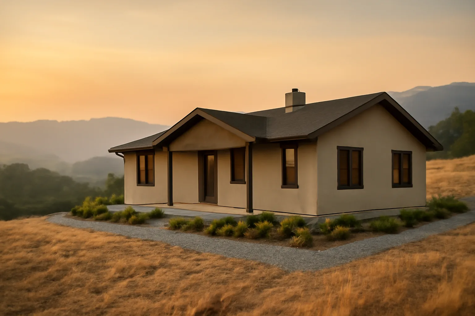
Wildfire mitigation at your house comes down to three things: what's touching the structure, what can throw embers onto it, and how far flame can reach before it hits something flammable. CAL FIRE's defensible space framework breaks this into zones, and the science behind it (much of it from the Insurance Institute for Business & Home Safety and USDA Forest Service research on home ignition) says embers, not walls of flame, cause most home losses in wildfires. The highest-value work is close to the house, not far from it. Zone 0, the 0 to 5 foot ring around your foundation, deck, and any attached structure, should have no combustible mulch, no stored firewood, no dry vegetation, and ideally noncombustible ground cover like gravel or pavers. This is the zone CAL FIRE and the state legislature have targeted with a new ember-resistant zone requirement (more below). Beyond Zone 0, Zone 1 runs 5 to 30 feet and calls for widely spaced, low-growing plants and removal of "ladder fuels" (shrubs under trees that let fire climb into the canopy). Zone 2, 30 to 100 feet, is about reduced fuel volume, not bare dirt. None of this requires a barren yard. It requires spacing, plant choice, and maintenance. The home itself matters as much as the yard. Ember-resistant vents (models tested to the flame and intrusion standards in California's SFM 12-7A-1 test protocol), a Class A fire-rated roof, and enclosed eaves close off the paths embers use to get inside attics and crawl spaces. A 2018 IBHS study of the Tubbs and other California fires found homes with noncombustible roofing and 5 feet of clearance survived at dramatically higher rates than neighbors without it. For a room-by-room look at what actually stops embers, see fire safe landscaping California next to house and defensible.
When does the California defensible space law go into effect?
California's existing defensible space law (Public Resources Code 4291) has been in effect since it was last substantially amended in 2020, requiring 100 feet of defensible space around structures in State Responsibility Areas and some local Very High Fire Hazard Severity Zones [1]. That part isn't new and it isn't changing. What is new: California's ember-resistant "Zone 0" requirement, created by Assembly Bill 3074 (2020) and developed through CAL FIRE Board of Forestry rulemaking, has been delayed multiple times. As of this writing, CAL FIRE and the Board of Forestry have not finalized the Zone 0 regulation text, and the effective date has slipped past its originally discussed 2023 and 2025 targets. Homeowners should check the Board of Forestry's current rulemaking page directly rather than trust a fixed date, because it has moved before [2]. [Fill in your local fire district's current defensible space effective date and inspection cycle here.] The safest move is to build to the strictest version of the rule now (5 feet of noncombustible material touching the house) rather than wait for the regulation to be finalized, since insurers are already asking about it in inspection letters.
What fire-safe rules for homes take effect in 2026?
Nobody should treat 2026 as a single hard deadline; the honest answer is that several overlapping rules are converging around that year, and which ones apply to you depends on your county, fire district, and whether your home is in a State Responsibility Area or a local Very High Fire Hazard Severity Zone. California's Zone 0 ember-resistant zone rule, once finalized by the Board of Forestry and Fire Protection, is expected to phase in with new construction first and existing homes on a longer timeline; CAL FIRE's own defensible space page is the authoritative source to check before you assume a date. Some insurers are not waiting for the state and are already requiring 5-foot noncombustible clearance as a condition of renewal in their own underwriting guidelines. Oregon's statewide wildfire risk map and defensible space code (tied to Senate Bill 762, passed 2021) has gone through its own multi-year revision after public pushback over risk classifications, and the Oregon Department of Forestry restarted its mapping process; check ODF's current program page for your property's status rather than an old map [3]. [Fill in your state fire marshal's specific 2026 code adoption date and whether it applies to new construction, remodels, or existing homes here.] Because rules vary this much by district, the single best use of an afternoon is pulling your specific fire district's current defensible space ordinance and inspection checklist, not guessing based on a neighboring county.
Why won't people follow the defensible space law in California?
This is worth asking honestly instead of assuming laziness. Compliance with Public Resources Code 4291 is inconsistent, and CAL FIRE's own inspection data shows a meaningful share of properties fail their first inspection every year [1]. The reasons are practical, not moral. Cost is real. Removing mature trees, regrading slopes, replacing wood mulch with gravel, and hiring a licensed contractor for a quarter-acre lot can run into the thousands of dollars, and there's no statewide subsidy that covers most of it. Some counties and Fire Safe Councils offer chipper days or cost-share grants, but availability is spotty and often oversubscribed. Enforcement is uneven. Many State Responsibility Area inspections happen on a multi-year cycle, not annually, and follow-up on a failed inspection can take months. When the penalty for non-compliance feels distant and the cost of compliance is immediate, people delay. There's also a genuine information gap. Homeowners are told to remove "ladder fuels" and maintain "defensible space" without a clear, room-by-room checklist for their specific property, and the rules read differently depending on whether you're in a State Responsibility Area, a Local Responsibility Area, or unincorporated county land. A lot of noncompliance is confusion, not defiance. And some of it is aesthetic and emotional. Mature trees and established landscaping took decades to grow, and people are reasonably reluctant to cut down a tree they planted for a shade that a wildfire inspector says has to go.
How to prevent wildfires (what actually reduces ignition risk)
Most wildfires in the US are human-caused, not lightning-caused. The National Interagency Fire Center and USDA Forest Service research put the human-caused share at roughly 85 to 90 percent of wildfires nationally in recent years, driven by equipment sparks, unattended campfires, debris burning, and downed power lines [4]. At the community and personal level, prevention means controlling ignition sources: don't operate mowers, chainsaws, or off-road vehicles on dry grass during red flag warnings; fully extinguish campfires (drown, stir, drown again); never discard cigarettes from a vehicle; and check local burn permit status before any debris burning, since many counties suspend permits entirely during fire season. Utilities matter too. Downed and arcing power lines have caused some of California's most destructive fires, including the 2018 Camp Fire, which CAL FIRE's investigation attributed to Pacific Gas & Electric transmission equipment [5]. Utility vegetation management and Public Safety Power Shutoffs are now standard tools in high-risk counties, and homeowners near transmission corridors should know their utility's PSPS schedule and have a backup power plan. At the policy level, prescribed burning and mechanical fuel treatments (thinning overstocked forests) reduce the fuel load available to burn. The US Forest Service has stated that decades of fire suppression policy left many Western forests with unnaturally dense fuel loads, and its current strategy explicitly calls for expanded prescribed fire and mechanical thinning across tens of millions of acres.
How can we prevent forest fires at a landscape scale?
Forest-scale prevention is a different problem than home-scale mitigation, though the two connect. It relies on fuel treatments (prescribed burns, mechanical thinning, and fuel breaks), fire-adapted forest management, and rapid initial attack on new starts before they grow. The US Forest Service's 2022 "Wildfire Crisis Strategy" set a goal of treating an additional 20 million acres of National Forest System land and 30 million acres of other lands over a 10-year period, focused on the highest-risk "firesheds" that threaten communities. That's a landscape response, not something an individual homeowner can do, but it directly affects how fast a fire moves toward your neighborhood once it starts. At the community level, Firewise USA (a National Fire Protection Association program) helps neighborhoods organize collective fuel reduction, shared chipper days, and coordinated defensible space work, since a single well-hardened home surrounded by unmaintained neighboring lots is still at real risk from radiant heat and embers crossing property lines [6]. If your neighborhood isn't a recognized Firewise community, starting that conversation with neighbors is arguably more useful than perfecting your own five-foot zone in isolation.
How to avoid forest fires when you're the one out there
If you're camping, hiking, or working in fire-prone land, avoidance is mostly about timing and equipment discipline. Check local and national Red Flag Warning status before any activity involving sparks, flame, or hot exhaust; Red Flag Warnings from the National Weather Service mean low humidity, high wind, and dry fuels have combined to create conditions where a small spark becomes a large fire fast. Campfires need a cleared area down to mineral soil, should never be left unattended, and need to be fully cold to the touch before you leave, more than smoke-free. Ready.gov's wildfire preparedness guidance recommends checking with local authorities on current fire restrictions and burn bans before any outdoor burning, since restrictions change week to week during fire season . Vehicles and equipment are an underrated risk. Dragging trailer chains, driving on flat tires with exposed rims, or parking a hot vehicle on dry grass are documented causes of roadside ignitions across California and the West, and several large fires have started this exact way.
How to prepare for a wildfire before it starts
Preparation splits into two categories: getting your property ready to survive without you there, and getting your household ready to leave fast. Ready.gov recommends assembling a go-bag with a multi-day supply of water, medications, copies of insurance documents, and a battery-powered radio, and doing this well before fire season, not the night a warning is issued . On the documentation side, take dated, wide-angle photos and video of your home's exterior, roof, vent screens, defensible space zones, and any recent hardening work (new vents, gutter guards, deck skirting). Insurers increasingly ask for this kind of evidence at renewal, and having it ready before a non-renewal letter arrives puts you in a much stronger position than scrambling afterward. This is the exact gap the $99 Wildfire Insurance Survival Kit is built to close: a structured way to document defensible space work and home-hardening upgrades in the format insurers actually want to see, without you having to guess at the checklist yourself. Household-level prep also means practicing your evacuation route (know at least two ways out of your neighborhood), signing up for county-level emergency alerts, and deciding in advance what irreplaceable items go in the car first. Waiting to make that list during an actual evacuation order costs minutes you may not have.
How to prepare for forest fires if you live near wildland
Living adjacent to wildland (the wildland-urban interface, or WUI) means your prep needs to go further than a typical suburban home. Maintain the full 100-foot defensible space required under Public Resources Code 4291 where it applies, more than the 30-foot zone closest to the house, and re-treat it annually since brush and grass regrow every season [1]. Store a water source with independent power. A generator-fed pump or gravity-fed tank matters if grid power fails during a fire, since municipal water pressure can drop when many hydrants draw simultaneously. Check with your specific fire district on brush disposal and chipping programs; many Fire Safe Councils run free or subsidized chipper days specifically for WUI properties, and using them is usually cheaper than hauling debris yourself. [Fill in your local Fire Safe Council's chipper day schedule and contact here.] Finally, know your evacuation zone designation if your county uses one (many California counties now use Genasys or similar zone-based alert systems), and register for text alerts tied to that zone specifically, more than a general county notification list.
Is Santa Barbara safe from fire?
No coastal California city is "safe" from wildfire in an absolute sense, and Santa Barbara County has a documented history that argues against complacency. The 2017 Thomas Fire, which started in Ventura County and burned into Santa Barbara County, was at the time the largest wildfire in modern California history by acreage, and it was followed days later by the Montecito debris flow that killed 23 people, a disaster directly tied to the burn scar's loss of ground cover . Much of Santa Barbara's hillside and foothill housing sits in or adjacent to Very High Fire Hazard Severity Zones as mapped by CAL FIRE, meaning defensible space requirements under Public Resources Code 4291 apply, and Santa Barbara County Fire Department conducts its own inspection program in these zones . The honest answer for a Santa Barbara homeowner is the same as for anyone in a mapped hazard zone: risk is not eliminated by geography or proximity to the ocean, only reduced by defensible space work, home hardening, and insurance documentation, and CAL FIRE's hazard severity maps for the county are the right first stop to check your specific parcel's designation .
What should homeowners document before an insurer sends a non-renewal letter?
| Roof and vent photos | Annually, before renewal | Ember intrusion is the leading home-loss mechanism | |
|---|---|---|---|
| Zone 0 (0-5 ft) photos | Annually, after spring cleanup | New AB 3074 ember-resistant zone standard [2] | |
| Defensible space inspection copy | Whenever your district inspects | Proves PRC 4291 compliance [1] | |
| Vegetation clearance receipts | Whenever work is done | Shows ongoing maintenance, not one-time cleanup | We don't file claims or promise any coverage outcome, that's not something any documentation product legitimately can do. What good documentation does is put the facts of your mitigation work in front of the insurer in a clear, dated, organized form, so the decision they make is based on your actual property, not a generic risk score. For readers who've already had a fire event and are dealing with a claim, our house fire and fire at a house guides cover that process separately. |
By the time a non-renewal or inspection letter shows up, you're already playing defense. The better position is documenting proactively, ideally every year before your renewal date. At minimum, keep: dated photos of all four sides of the house showing roof condition and vent screens, photos of the 5-foot zone around the foundation showing noncombustible material, receipts or contracts for any tree removal, brush clearing, or gutter guard installation, and a copy of your most recent defensible space inspection (if your fire district performs one). A simple table of what to capture and how often: | Item | Frequency | Why insurers ask |
What does defensible space actually require, zone by zone?
| Zone 0 (ember-resistant) | 0-5 feet | Noncombustible material only; no mulch, no stored wood, no dry plants touching the house | |
|---|---|---|---|
| Zone 1 | 5-30 feet | Widely spaced, low, well-irrigated plants; remove ladder fuels under trees | |
| Zone 2 | 30-100 feet | Reduced fuel volume; mowed grass under 4 inches; thinned brush | These distances are minimums under Public Resources Code 4291, and some Very High Fire Hazard Severity Zone jurisdictions apply the full 100 feet even on smaller lots, cutting off at the property line if it's shorter [1]. Plant choice inside Zone 1 and 2 matters almost as much as spacing; some ornamental species (certain junipers, for example) carry high oil content and burn hotter and faster than others. See fire safe landscaping California next to house for a species-level breakdown, and only you can prevent wildfires for the classic Smokey Bear framing of personal responsibility that still underlies most state prevention messaging today. [Fill in your specific fire district's defensible space distance requirements and inspection frequency here, since some jurisdictions modify the state minimums.] |
Here's the zone breakdown most California fire districts use, adapted from CAL FIRE's defensible space guidance: | Zone | Distance from structure | Core requirement |
How does defensible space clearing get done, and who pays?
For homeowners without the physical capacity or time to do the clearing themselves, licensed vegetation management contractors handle everything from tree limbing to brush removal to hauling. Pricing varies enormously by lot size, slope, and vegetation density, commonly ranging from several hundred dollars for a small, flat, lightly vegetated lot to several thousand for a large, sloped, heavily wooded parcel; get at least two local quotes rather than trusting a single estimate. Some states have formal programs. Washington's Department of Natural Resources, for instance, runs cost-share and contractor-connection programs for defensible space work in wildfire-prone counties; our guide to wildfire defensible space clearing contracts in Washington state walks through how that program works and how to find a qualified contractor. Whatever program or contractor you use, keep the paperwork. A signed contract and completion photos are exactly the kind of dated evidence that supports both your defensible space compliance and your insurance documentation file.
Frequently asked questions
When does the California defensible space law go into effect?
The core 100-foot defensible space requirement under Public Resources Code 4291 is already in effect and has been enforced for years. The newer ember-resistant Zone 0 rule (5-foot noncombustible zone) is still being finalized by CAL FIRE's Board of Forestry and Fire Protection, with the effective date having slipped past earlier proposed dates. Check the Board's current rulemaking page for the latest status before assuming a specific date applies to you.
Why won't people follow the defensible space law in California?
Mostly cost, inconsistent enforcement, and confusion, not defiance. Clearing a quarter-acre lot can cost thousands of dollars with no statewide subsidy covering most of it, inspections often happen on multi-year cycles rather than annually, and the rules read differently depending on whether a property sits in a State Responsibility Area, Local Responsibility Area, or unincorporated county land.
How to prevent wildfires as an individual?
Control ignition sources: don't run mowers or chainsaws on dry grass during red flag warnings, fully drown and stir campfires before leaving, never toss cigarettes from a car, and check local burn permit status before any debris burning. Roughly 85 to 90 percent of US wildfires are human-caused according to federal fire agency data, so individual ignition discipline matters more than most people assume.
How to prepare for a wildfire if you get a warning?
Have a go-bag ready with water, medications, and insurance documents per Ready.gov guidance, know at least two evacuation routes out of your neighborhood, and sign up for county-level emergency alerts before fire season starts. Photograph your home's defensible space and hardening work now, since documentation gathered before a crisis is far more useful than anything assembled during an evacuation order.
How to prevent forest fires at a landscape level?
Landscape-level prevention relies on prescribed burning, mechanical fuel thinning, and reducing dense forest fuel loads built up from decades of fire suppression. The US Forest Service's Wildfire Crisis Strategy targets treating an additional 20 million acres of National Forest System land over 10 years, focused on the highest-risk areas near communities.
How to avoid forest fires while camping or working outdoors?
Check Red Flag Warning status before any spark-producing activity, clear campfire sites to mineral soil, never leave a fire unattended, and confirm it's cold to the touch (more than smoke-free) before leaving. Avoid dragging trailer chains or parking hot vehicles on dry grass, both documented causes of roadside wildfire starts.
How to prepare for forest fires if you live in the wildland-urban interface?
Maintain the full 100-foot defensible space required under Public Resources Code 4291 where applicable, re-treat it annually as vegetation regrows, and consider an independently powered backup water source since municipal pressure can drop during active fires. Use local Fire Safe Council chipper days where available to reduce disposal cost.
What fire-safe rules for homes take effect in 2026?
There's no single nationwide 2026 deadline; California's Zone 0 ember-resistant zone regulation and Oregon's wildfire risk map and code requirements are both mid-revision and vary by county and fire district. Check CAL FIRE's defensible space page or your state fire marshal's site directly rather than relying on a fixed date, since these rules have already been delayed more than once.
Is Santa Barbara safe from fire?
No coastal California city is fully safe from wildfire risk. The 2017 Thomas Fire burned into Santa Barbara County and was, at the time, the largest wildfire in modern California history, followed by a deadly debris flow in Montecito. Much of the county's foothill housing sits in CAL FIRE-mapped Very High Fire Hazard Severity Zones subject to defensible space law.
How can we prevent forest fires as a community?
Firewise USA, a National Fire Protection Association program, helps neighborhoods coordinate shared fuel reduction and chipper days, which matters because one hardened home surrounded by unmaintained lots is still exposed to radiant heat and embers crossing property lines. Community-level coordination often reduces risk more per dollar than one household perfecting its own yard alone.
What is Zone 0 and why is it different from regular defensible space?
Zone 0 is the 0 to 5 foot ring directly touching a home's foundation, deck, and attached structures, and it requires noncombustible material only (no mulch, stored wood, or dry plants). It's the newest layer of California's defensible space framework, created under Assembly Bill 3074 and still being finalized through CAL FIRE Board of Forestry rulemaking.
Do insurers actually check defensible space before renewing a policy?
Increasingly, yes. Many carriers in California, Colorado, Oregon, and Arizona now request photos or third-party inspection reports showing defensible space compliance and home hardening features like ember-resistant vents before renewing wildfire-zone policies. Keeping dated photos and contractor receipts on hand each year makes that documentation request far less stressful.
What percentage of wildfires are caused by humans?
Roughly 85 to 90 percent of wildfires in the United States are human-caused, according to National Interagency Fire Center and USDA Forest Service data, stemming from equipment sparks, unattended campfires, debris burning, and downed power lines rather than lightning.
Sources
- California Legislature, Public Resources Code Section 4291: 100-foot defensible space requirement around structures in State Responsibility Areas
- California Board of Forestry and Fire Protection, Rulemaking: Zone 0 ember-resistant zone regulation is still in rulemaking and has been delayed past earlier target dates
- CAL FIRE, Camp Fire Investigation: CAL FIRE investigation attributed the 2018 Camp Fire to PG&E transmission equipment
- USDA Forest Service, Wildfire Crisis Strategy: Forest Service goal to treat an additional 20 million acres of National Forest System land over 10 years
- National Fire Protection Association, Firewise USA program: Firewise USA helps neighborhoods coordinate collective fuel reduction and defensible space work
- CAL FIRE, Fire Hazard Severity Zone Maps: CAL FIRE maps Very High Fire Hazard Severity Zones including areas of Santa Barbara County