Last updated 2026-07-23
TL;DR
Firescaping is landscaping designed around defensible-space zones (0-5, 5-30, 30-100 ft) to slow flame spread and block embers. It relies on plant spacing, moisture, and non-flammable material near the house, not one magic plant. California's new Zone 0 ember-resistant zone rule is still pending final regulations as of 2025, with an effective date not yet locked by the Board of Forestry.
what is firescaping, exactly?
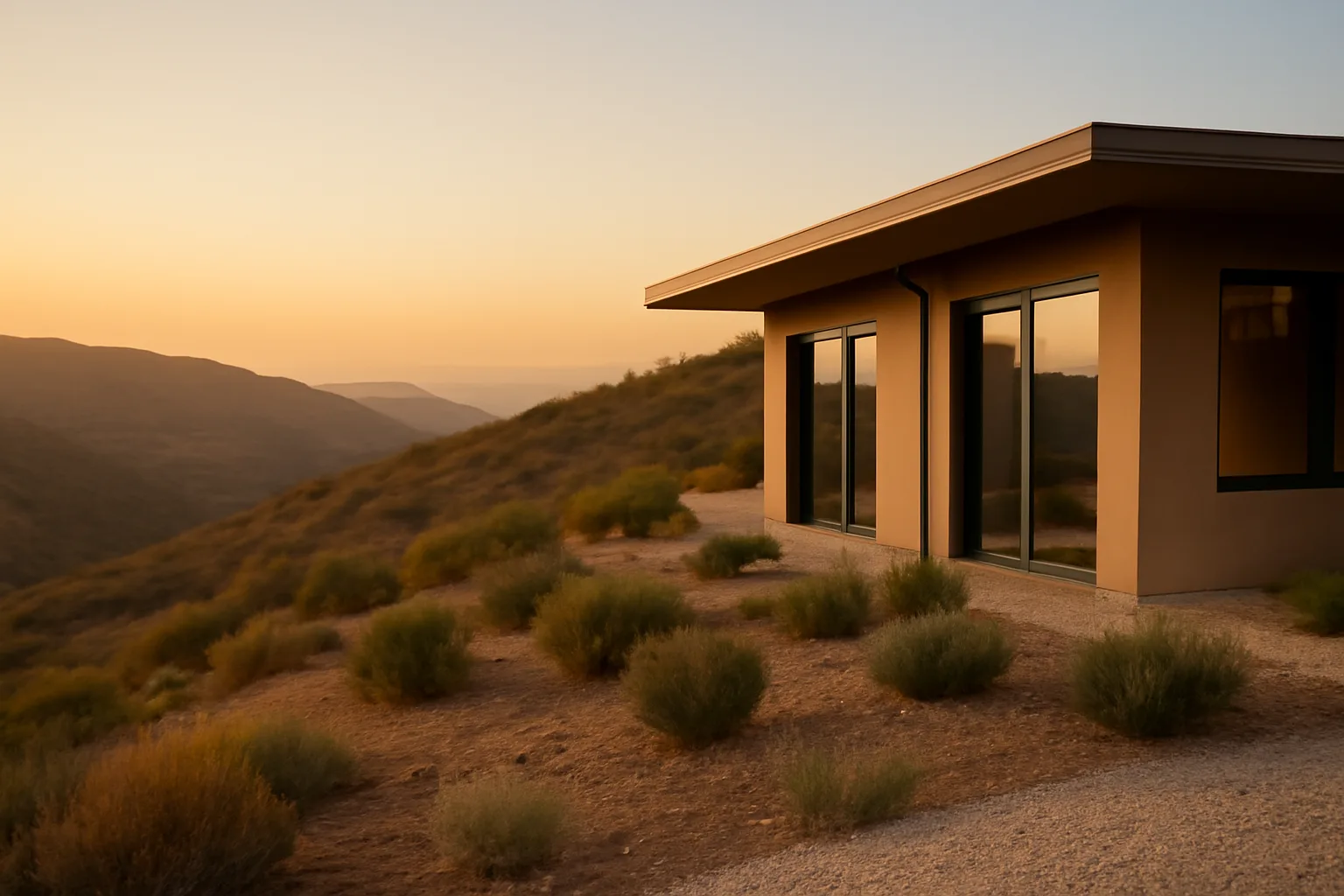
Firescaping is the practice of designing and maintaining a landscape to slow wildfire spread and reduce ember ignition around a structure. It's not a plant list you buy at a nursery and call done. It's a system: spacing between plants, vertical and horizontal fuel breaks, irrigation habits, and material choices that change depending on how close you get to the house. The term got popular in California in the 1990s but the underlying science comes from CAL FIRE's defensible space research and decades of post-fire damage assessments. After the 2007 Witch Creek and 2003 Cedar fires, researchers doing structure-by-structure surveys kept finding the same pattern: homes that survived usually had cleared, low-fuel zones within the first several feet, while homes that burned often had shrubs, mulch, or wood fencing touching the siding. Firescaping formalizes that pattern into three zones under California's Public Resources Code 4291: Zone 0 (0-5 feet from structures), Zone 1 (5-30 feet), and Zone 2 (30-100 feet). Each zone has different rules for what can grow there and how it has to be maintained. For a full zone-by-zone breakdown, see defensible space zones. What firescaping is not: a guarantee. No landscaping design stops a wind-driven crown fire cold. What it does is reduce the odds that embers landing in your yard find something to ignite, and it buys firefighters (or you) more time and safer access if flames do reach the property line.
why won't people follow the defensible space law in california?
This is the honest, uncomfortable question, and the data on compliance is thin because nobody tracks it well statewide. CAL FIRE and local fire agencies that do inspections report noncompliance rates that run anywhere from 10% to over 50% depending on the county and year, based on published inspection summaries from individual fire districts. There's no single national database, so treat any specific percentage you see with some skepticism. The reasons people skip it aren't usually ignorance. A few show up again and again in county fire department outreach materials and public comment records: Cost is the biggest one. Removing mature trees, regrading slopes, or hauling away brush on a hillside lot can run into the thousands of dollars, and low-income and elderly homeowners on fixed incomes often can't absorb that in one season. Aesthetics and shade matter more than people admit. A mature oak or a wall of junipers next to the house cools the yard and blocks a neighbor's view into your windows. Cutting it back 5 to 30 feet feels like giving something up for a fire that might never come. Enforcement is inconsistent. Some counties do annual defensible space inspections and issue notices of violation with real follow-through. Others rely almost entirely on self-certification or complaint-driven inspections, so a homeowner who never gets a knock on the door never has a forcing function. And frankly, some people just don't believe it will happen to them, or they've lived somewhere 20 years without a fire and don't see the odds changing. That's a real psychological pattern seen across natural hazard research generally, not unique to wildfire.
how to prevent wildfires around your own property
You can't prevent wildfire itself. Ignition sources (lightning, power lines, equipment sparks, arson, escaped campfires) are mostly outside your control. What you can do is reduce the chance that a wildfire becomes a structure fire once it reaches your neighborhood. CAL FIRE's core guidance breaks this into the zone system already mentioned, plus specific ember-hardening steps for the house itself. Roughly 90% of homes lost in wildland-urban interface fires ignite from ember showers landing on or near the structure, not from direct flame contact, according to research summarized by the Insurance Institute for Business & Home Safety (IBHS). That single fact should reorder your priorities: gutters, vents, roof valleys, and the first 5 feet of ground matter more than most people think. Practical steps that actually move the needle: - Clear Zone 0 (0-5 ft) of anything combustible: mulch, dead leaves, wood piles, planter boxes touching siding.
- Screen attic and foundation vents with 1/8-inch metal mesh to block ember entry, per CAL FIRE's home hardening guidance.
- Clean gutters and roof valleys of pine needles and leaf litter before fire season.
- Keep tree canopies at least 10 feet from chimneys and roof lines.
- Space shrubs so mature growth won't create a continuous fuel ladder from ground to canopy. For the house-specific side of this (siding, roofing, vents, windows), see fire safe landscaping California next to house and home hardening basics.
how to prepare for a wildfire (the household plan, more than the yard)
Firescaping handles the property. Preparedness handles the people. Ready.gov, the federal emergency preparedness site run by FEMA, recommends every household in a wildfire-prone area have an evacuation plan practiced at least twice a year, a go-bag ready, and a way to receive emergency alerts that doesn't depend on cell towers staying up. The specific list Ready.gov recommends includes: a battery or hand-crank radio, N95 masks for smoke, copies of insurance documents and ID, a week of medications, and a plan for pets and livestock. If you're in a fire district with mandatory evacuation zones, know your zone number before fire season starts, not during it. One part people skip: documentation. If your home is damaged or lost, you'll need to prove what you owned and its condition before the fire. Photos and video of every room, receipts for major purchases, and a copy of your policy declarations page are the things insurers and adjusters ask for first. This is also the point where a pre-built kit, like the $99 Wildfire Insurance Survival Kit at /survival-kit-builder, can save you from scrambling for paperwork in the middle of an evacuation order. It doesn't file claims for you or handle your insurer conversations. You still send your own documentation. It just makes sure you have it organized before you need it. For a broader look at what happens structurally during a home fire and what's salvageable, see house fire and fire at a house.
how to prevent forest fires (the bigger picture beyond your yard)
Preventing forest fires at the landscape level is mostly a public land management and ignition-source problem, and it's bigger than any single homeowner. The U.S. Forest Service estimates roughly 85% of wildfires nationally are human-caused, from unattended campfires, debris burning, equipment sparks, and downed power lines, according to National Interagency Fire Center data [1]. At the individual level, the things that actually reduce forest fire starts are unglamorous: fully extinguishing campfires (drown, stir, feel for heat, repeat), not parking hot vehicles on dry grass, following local burn permit rules, and reporting downed lines immediately. CAL FIRE's "One Less Spark" campaign focuses on exactly these behaviors because they're the ignition sources people can actually control. At the community level, fuel breaks, prescribed burns, and forest thinning done by agencies like CAL FIRE and the U.S. Forest Service reduce the amount of continuous fuel available to carry a fire once it starts. Homeowners can support this indirectly by not blocking prescribed burn programs in their area and by maintaining defensible space so agencies aren't forced to choose between saving structures and managing the broader fire. The phrase "only you can prevent forest fires" comes from Smokey Bear, and it's not wrong, it's just incomplete. Individual ignition prevention matters, but so does landscape-scale fuel management that no single homeowner controls. See only you can prevent wildfires for more on that history and what it does and doesn't cover.
when does the california defensible space law go into effect?
Public Resources Code 4291, requiring 100 feet of defensible space around structures in State Responsibility Areas, has been in effect since it was expanded to 100 feet in 2005. That part of the law is not new and not pending. If you own a home in a State Responsibility Area or certain Local Responsibility Areas with a Very High Fire Hazard Severity Zone designation, the 100-foot requirement already applies to you. What's still pending, and where the confusion comes from, is Zone 0. California's SB 63 (2020) directed the Board of Forestry and Fire Protection to develop a new "ember-resistant zone" regulation for the 0-5 foot area immediately around structures, going further than existing defensible space rules by potentially restricting nearly all combustible material in that band. As of the Board's public update process through 2024 and 2025, the Zone 0 regulation was still in draft and public comment stages, without a locked statewide effective date. Homeowners should check the Board of Forestry and Fire Protection's official site directly for the current status rather than relying on any date circulating online, because it has shifted more than once. Guided fill-in: check your specific fire district's local ordinance, since some counties and fire districts have already adopted Zone 0-style rules ahead of the state timeline. [Enter your county/fire district name] to find your local requirement, since enforcement timelines vary by jurisdiction even before the state rule locks in.
what fire safe rules for homes take effect in 2026?
There is no single, confirmed nationwide "2026 fire safe homes" mandate as of this writing. What exists is a patchwork of state and local rule changes moving on different timelines, and some genuinely target 2025-2026 windows. California's Zone 0 ember-resistant zone rule, discussed above, has been publicly discussed with target implementation dates that have moved (early drafts referenced 2023, then delayed). Homeowners in high-risk zones should check CAL FIRE's official defensible space page directly for the current adopted timeline rather than assume any specific year. Oregon's statewide wildfire risk map and defensible space code, created under Senate Bill 762 (2021), has also had a bumpy rollout, with the original risk map withdrawn in 2022 after public pushback and reissued later under a revised process through the Oregon Department of Forestry. Check the Oregon Department of Forestry's site for your property's current designation before assuming a rule applies to you. Colorado and Arizona don't have a single statewide defensible space statute as sweeping as California's; requirements are set more at the county and fire district level. This is a case where the honest answer is: check your specific state fire marshal's office and local fire district, because "2026 rules" mean different things in different states, and treating any one number as universal will mislead you. Guided fill-in: [enter your state] fire marshal's office publishes the current adopted code and any pending 2025-2026 amendments.
is santa barbara safe from fire?
No coastal California city is fully safe from fire, and Santa Barbara County has a documented history that says otherwise directly. The 2017 Thomas Fire burned over 281,000 acres and was, at the time, the largest wildfire in modern California history, followed within weeks by the Montecito debris flow that killed 23 people, an event tied directly to the burned, denuded hillsides left by the fire. Santa Barbara sits against steep, chaparral-covered mountains with a strong offshore wind pattern (sundowner winds) that has driven multiple major fires through the area, including the 1990 Painted Cave Fire and the 2008 Tea Fire. The Santa Barbara County Fire Department maintains Very High Fire Hazard Severity Zone maps covering large parts of the foothill and mountain-adjacent neighborhoods, meaning defensible space law under PRC 4291 applies directly to many Santa Barbara homes. So the realistic answer: Santa Barbara is not immune, it's one of the more fire-exposed metro areas in California specifically because of its topography and wind patterns. If you own property there, check your parcel against the county's Fire Hazard Severity Zone map before assuming your neighborhood is exempt. Homes closer to the wildland-urban interface (the foothills, San Roque, Mission Canyon, Montecito) carry meaningfully higher exposure than downtown or beachfront parcels.
what plants actually work in a firescaped yard?
| Zone 0 | 0-5 ft | Gravel, stone, hardscape, isolated low-moisture succulents | Mulch, wood fencing touching house, shrubs against siding | |
|---|---|---|---|---|
| Zone 1 | 5-30 ft | Spaced, irrigated plants, mowed grass under 4 inches | Continuous shrub lines, dead branches, ladder fuels | |
| Zone 2 | 30-100 ft | Thinned trees, reduced ground fuel, spaced native plantings | Dense brush, unmanaged dead fall, fuel ladders to canopy | Source: CAL FIRE defensible space zone guidance. For plant-specific advice tied to your zone, see fire safe landscaping California next to house. |
There's no fireproof plant. Every living plant will burn under the right heat and wind conditions. What firescaping does is choose plants with higher moisture content, lower resin and oil content, and less dead material buildup, then space and maintain them so they don't create a continuous path for flame. CAL FIRE and UC Cooperative Extension both publish fire-resistant plant lists, and the patterns are consistent: low-growing succulents, many California natives like California lilac (spaced, not massed) and toyon, and well-irrigated groundcovers do better than resinous shrubs like juniper, rosemary massed in hedges, or eucalyptus. Eucalyptus in particular is flagged repeatedly in CAL FIRE materials because of its oil content and tendency to shed large amounts of bark and litter. Spacing matters more than species in a lot of cases. A juniper hedge trimmed and irrigated with 6 feet of clearance between plants behaves very differently in a fire than the same species grown as one continuous unmaintained mass touching a fence line. | Zone | Distance from structure | What's allowed | What to avoid |
how does firescaping differ across CA, CO, OR, and AZ?
The core science is the same everywhere: reduce fuel continuity, harden the first few feet around the structure, manage moisture. But the legal requirements and typical fuel types differ enough that a firescaping plan built for one state doesn't transfer cleanly to another. California has the most codified system, built around PRC 4291's 100-foot, three-zone structure, with Zone 0 rules still finalizing. Oregon's SB 762 framework ties defensible space requirements to a statewide risk map that has been revised after public pushback, so requirements can shift by property depending on the current map version. Colorado doesn't have one statewide mandate; defensible space requirements are largely set by county wildfire mitigation codes and by individual fire protection districts, so a property in Boulder County may face different rules than one in El Paso County. Arizona similarly handles this at the state forestry division and local fire district level rather than through one uniform statute. Fuel type also changes the priorities. California and Southern Oregon deal heavily with chaparral and resinous brush. Colorado's mountain communities deal more with dense conifer stands (lodgepole pine, Douglas fir) where crown fire risk from ladder fuels is the bigger concern. Arizona's high desert and chaparral transition zones bring their own mix, often with less rainfall to keep firescaped plantings healthy without extra irrigation. Guided fill-in: [enter your state and county] to check the specific defensible space ordinance that applies to your property, since this article can't substitute for your local fire district's adopted code.
what does a realistic firescaping project cost and where do you start?
There's no single national average because it depends entirely on lot size, slope, existing vegetation, and whether you hire it out or do it yourself. A flat, small suburban lot needing basic Zone 0-1 cleanup (removing mulch against the house, trimming shrubs back, clearing gutters) might run a few hundred dollars in a weekend of DIY labor plus disposal fees. A hillside acre-plus parcel with mature trees needing Zone 2 thinning, stump removal, and slope grading can run into the tens of thousands when done by licensed contractors, especially in areas requiring permitted tree removal. Start with Zone 0. It's the cheapest to fix and has the highest payoff, since ember ignition at the structure itself causes most WUI home losses according to IBHS research. Clear combustibles within 5 feet, screen your vents, clean your gutters. That's a weekend project for most homeowners and it's free or nearly free if you're just hauling away material you already have. Then move outward. Zone 1 (5-30 ft) usually means spacing and pruning existing plants rather than wholesale removal, which keeps cost down. Zone 2 (30-100 ft) is where cost jumps if you have mature trees or dense brush, because that often means arborist work or licensed tree removal, more than weekend labor. If you're in a state with clearing assistance programs, check them before paying full retail. Washington State DNR, for example, runs cost-share and contractor programs for defensible space clearing; see wildfire defensible space clearing contracts Washington State DNR for how that model works, since several other Western states have modeled similar programs.
what to do if you got a non-renewal or inspection letter
If you're reading this because an insurer sent a non-renewal notice or a fire district sent an inspection deficiency letter, the order of operations matters. First, read exactly what the letter cites; most inspection letters specify a code section (often PRC 4291 in California) and a deadline. Fix the cited items first, not what you assume they mean. Second, document before and after. Photograph every zone from multiple angles before you touch anything, then again after the work is done. If you ever need to show an insurer or fire district that you complied, dated photos matter more than a verbal claim that you did the work. Third, understand what you're not required to do versus what's a genuine ask. Insurers sometimes ask for more than statute requires, particularly around Zone 0 material choices, because their underwriting models look at total ember exposure, more than legal minimums. You're allowed to ask them, in writing, exactly which standard they're applying. This is not legal, insurance, or claims advice, and nothing here handles your insurer conversations for you. What it does help with is organizing your own documentation before and after mitigation work, which is exactly what the $99 Wildfire Insurance Survival Kit at /survival-kit-builder is built for: a structured way to log photos, dates, and receipts so you're not reconstructing a compliance timeline from memory when a deadline or a claim is on the line. You still file your own paperwork and make your own calls to your insurer.
Frequently asked questions
When does the California defensible space law go into effect?
The core 100-foot defensible space requirement under Public Resources Code 4291 has been in effect since 2005. The newer Zone 0 (0-5 foot) ember-resistant zone rule from SB 63 (2020) is still finalizing through the Board of Forestry and Fire Protection as of 2025, with no locked statewide effective date yet. Check the Board's official site for current status.
Why won't people follow the defensible space law in California?
Cost, aesthetics, and inconsistent enforcement are the main reasons cited in county fire department outreach data. Clearing mature trees or regrading a hillside can cost thousands, some homeowners value shade and privacy over compliance, and enforcement varies widely by county, from strict annual inspections to complaint-driven follow-up only.
How to prevent wildfires from starting near my home?
Extinguish campfires completely (drown, stir, feel), avoid parking hot vehicles on dry grass, follow local burn permit rules, and report downed power lines immediately. Roughly 85% of U.S. wildfires are human-caused according to National Interagency Fire Center data, so controlling ignition sources is the most direct prevention step available to individuals.
How do I prepare for a wildfire evacuation?
Ready.gov recommends a practiced evacuation plan, a go-bag with a week of medications, N95 masks, a battery or hand-crank radio, and copies of insurance documents and ID. Know your evacuation zone number before fire season starts, and photograph your home's contents now so you have documentation if you're displaced later.
How to prevent forest fires at a larger, landscape level?
Agencies like CAL FIRE and the U.S. Forest Service use prescribed burns, fuel breaks, and forest thinning to reduce continuous fuel loads across public land. Individuals support this by fully extinguishing fires, following burn permits, maintaining their own defensible space, and not obstructing agency-led prescribed burn programs in their area.
How to avoid forest fires when recreating outdoors?
Check local fire restrictions before lighting any fire, use established fire rings only, never leave a fire unattended, and carry water or a shovel to fully extinguish it (drown, stir, feel for heat). Avoid driving or parking on dry grass, since hot exhaust systems are a documented ignition source tracked by fire agencies nationally.
What fire safe rules for homes take effect in 2026?
There's no single confirmed nationwide 2026 mandate. California's Zone 0 ember-resistant zone rule has a moving timeline still in Board of Forestry review. Oregon's SB 762 risk map and code have also shifted after 2022 pushback. Check your state fire marshal's office directly rather than relying on any specific year circulating online.
Is Santa Barbara safe from fire?
No. Santa Barbara County has a documented history of major fires, including the 2017 Thomas Fire (over 281,000 acres) and the resulting Montecito debris flow that killed 23 people. Much of the county's foothill and mountain-adjacent area carries a Very High Fire Hazard Severity Zone designation under state mapping.
How can we prevent forest fires as a community?
Support local prescribed burn programs, comply with defensible space ordinances so agencies aren't forced to divert resources to structure protection, and report unattended campfires or downed lines. Community-level fuel breaks and coordinated thinning projects, often run through CAL FIRE or county fire districts, reduce fire spread more than any single property's efforts.
What is Zone 0 and why does it matter more than other zones?
Zone 0 is the 0-5 foot area immediately around a structure. It matters most because most wildland-urban interface home losses start from ember ignition at or near the structure, not direct flame contact, according to IBHS research. California's pending Zone 0 rule would restrict nearly all combustible material in this band.
Can I do firescaping myself or do I need a contractor?
Zone 0 and much of Zone 1 work (clearing mulch, screening vents, cleaning gutters, spacing shrubs) is DIY-friendly and often a weekend project. Zone 2 work involving mature tree removal, slope grading, or permitted tree work usually needs a licensed contractor or arborist, especially where local codes require permits for tree removal.
Does firescaping guarantee my house won't burn?
No landscaping design guarantees survival in a wind-driven wildfire. Firescaping reduces ignition probability by cutting ember fuel near the structure and slowing flame spread, but extreme conditions (high wind, long drought, dense adjacent fuel) can overwhelm even well-maintained defensible space. It's risk reduction, not risk elimination.
What plants should I never plant near my house in a fire zone?
CAL FIRE materials repeatedly flag resinous, oily plants like juniper massed in hedges, rosemary in dense rows, and eucalyptus, which sheds oily bark and litter. The bigger issue is often spacing and maintenance rather than species alone; even lower-risk plants become hazards when they're unmaintained and touching structures.
Sources
- National Interagency Fire Center, Statistics: Approximately 85% of U.S. wildfires are human-caused
- Cal Fire: California's defensible space law requires creating zones of reduced vegetation around structures to slow wildfire spread
- Cal Fire: Home hardening measures like ember-resistant vents and Class A roofing reduce wildfire risk to structures
- California Legislative Information: California Public Resources Code Section 4291 establishes defensible space clearance requirements around buildings
- California Department of Forestry and Fire Protection (Cal Fire) Office of the State Fire Marshal: The Office of the State Fire Marshal oversees defensible space zone regulations including the new Zone 0 ember-resistant zone
- National Fire Protection Association: Firewise USA program provides community-level guidance for reducing wildfire risk around homes
- Colorado State University Extension: Colorado State Extension provides firewise plant material recommendations for defensible landscaping
- California Department of Insurance: Homeowners facing non-renewal after wildfire risk assessment have rights and options under California insurance regulations