Last updated 2026-07-25
TL;DR
The California Board of Forestry and Fire Protection is the state body that writes wildfire fuel-reduction regulations, including the defensible space law (PRC 4291) and the new Zone 0 ember-resistant zone rule, which the board expects to finalize for a 2026 effective date. It doesn't inspect your house; local fire agencies and CAL FIRE do that.
What is the Board of Forestry and Fire Protection?
The Board of Forestry and Fire Protection (often shortened to BOF) is a nine-member state body, created by the California legislature, that sets policy and writes regulations for wildland fire protection and forest management in California. It sits inside the California Natural Resources Agency and works alongside CAL FIRE, but it's a separate rulemaking body, not an enforcement agency. Think of it this way: the board writes the rulebook, CAL FIRE and local fire departments carry it out. The board's statutory job includes classifying State Responsibility Areas (the wildland zones where the state, not a local city, has fire protection responsibility), setting fire hazard severity zone maps in cooperation with CAL FIRE, and adopting the technical regulations under California's defensible space law [1]. Members are governor-appointed and represent a range of interests: professional foresters, ranching, environmental groups, fire safety, and the public. Meetings are public and the board takes public comment on proposed regulations, which is how most defensible space rule changes (including the pending Zone 0 rule) work their way into law. If you got a non-renewal letter or a defensible space inspection notice, the rule your local fire marshal is enforcing almost certainly traces back to a regulation this board adopted under Public Resources Code section 4291.
When does the California defensible space law go into effect?
California's core defensible space law, Public Resources Code section 4291, has been in effect since 2005 and currently requires 100 feet of defensible space clearance around structures in State Responsibility Areas and designated Very High Fire Hazard Severity Zones in local jurisdictions [1]. It's not new. What's new, and still pending, is Zone 0. The law states that a person who owns, leases, controls, operates, or maintains a building in an SRA or a Very High FHSZ "shall maintain defensible space of 100 feet from each side and from the front and rear of the structure" [1]. That 100 feet is split into two zones: Zone 1 (0 to 30 feet, lean and green, remove dead material) and Zone 2 (30 to 100 feet, reduced fuel volume, more spacing between plants). Zone 0 is the newer piece. Senate Bill 63 (2020) directed the Board of Forestry to develop an ember-resistant zone regulation for the 0 to 5 foot area immediately next to a home, and the board has been working through the formal rulemaking process since. As of 2024-2025 the board had not finalized the Zone 0 regulation; it remains in the review and adoption pipeline, and the board's own public materials have referenced a 2026 target for when Zone 0 requirements would start applying to existing homes in the highest-risk zones [2]. Because rulemaking timelines can shift, check the board's current regulatory status page before assuming a hard date. For a plain breakdown of what goes in each ring around your house, see defensible space.
What fire-safe home rules take effect in 2026?
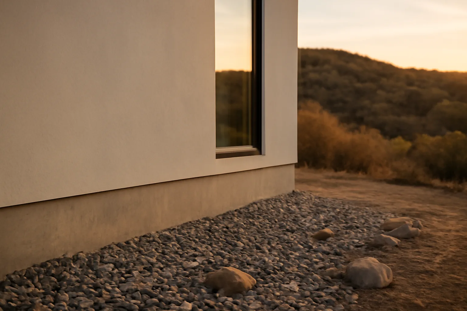
The headline 2026 item is Zone 0, the ember-resistant zone within 5 feet of a home's exterior walls. The concept, once adopted, would generally restrict combustible mulch, wood fencing attached to the house, stored firewood, and dense plantings within that 5-foot ring, replacing them with gravel, pavers, hardscape, or well-spaced low fuel plants [2]. The legal foundation is Senate Bill 63, chaptered in 2020, which added planning requirements for the board to adopt ember-resistant zone regulations "upon appropriation by the Legislature" [2]. That appropriation and formal rulemaking language is what's been working through the Office of Administrative Law process. Because the rule isn't finalized as of this writing, homeowners should treat any specific 2026 date as the board's stated intent, not settled law, and verify current status directly with CAL FIRE or the Board of Forestry before making expensive irreversible changes. Separately, California's building code already has fire-hardening requirements under Chapter 7A of the California Building Code, covering ignition-resistant construction (vents, roofing, siding, decking) for new construction and additions in Wildland-Urban Interface fire areas [3]. Those requirements are administered locally through building departments, not directly by the Board of Forestry, but the board's fire hazard severity zone maps are what trigger whether Chapter 7A applies to a given parcel. Bottom line for 2026 planning: don't wait for the final Zone 0 text to start clearing combustibles from the 5 feet nearest your walls. Every serious home-hardening guide, including CAL FIRE's own "Ready, Set, Go" material, already recommends it as best practice regardless of when it becomes mandatory.
Why won't people follow the defensible space law in California?
Nobody tracks a single clean number on statewide non-compliance, but the pattern shows up repeatedly in local inspection data and in reporting on why compliance lags. The honest answer is a mix of cost, confusion, and competing priorities, not simple stubbornness. Cost is real. Removing mature trees, regrading slopes, or replacing wood fencing near a house can run into the thousands of dollars, and low-income and elderly homeowners on fixed incomes often can't absorb that in one season. Some counties and CAL FIRE units run chipper programs or cost-share grants specifically because of this gap, but availability is inconsistent county to county. Confusion is the second driver. Zone boundaries, what counts as "reduced fuel volume" in Zone 2, and how HOA rules interact with defensible space law all create legitimate uncertainty. A homeowner who thinks their neighborhood's tree canopy is protected by a local tree ordinance may not realize state fire law can override that expectation near a structure. Third, enforcement has historically been uneven. Many local fire agencies inspect on a multi-year cycle, not annually, so a homeowner who skipped clearance last year may not have felt any consequence yet. That's changing as insurers tie renewal decisions directly to defensible space compliance, which is arguably doing more to drive real compliance right now than the regulatory enforcement mechanism itself. If you're unsure what your specific jurisdiction requires, mitigation rules vary by fire district: [confirm your local zone requirements and inspection cycle with your fire district] before assuming statewide 100-foot rules are the whole picture; some districts add stricter local ordinances on top.
How to prevent wildfires: what actually reduces risk at the home level
Preventing a wildfire from starting is mostly about human-caused ignition sources; preventing your home from burning once a fire is nearby is a separate, and more controllable, project. Most wildfires in the US are human-caused: debris burning, equipment sparks, unattended campfires, and vehicle-related ignitions account for the large majority of fire starts, according to National Interagency Fire Center data referenced by federal and state agencies. At the property level, prevention work breaks into three buckets: never letting an ignition source meet dry fuel (proper equipment use, no burning on red flag days, spark arrestors on machinery), maintaining defensible space so a fire that reaches your property has less to burn, and hardening the structure itself so embers landing on or near it don't ignite the building. Embers, not the flame front, ignite most homes in wildfires. Research summarized by the Insurance Institute for Business & Home Safety and referenced in CAL FIRE's home hardening guidance points to embers and small flames as the dominant way homes ignite during wildfires, which is why vent screening, roofing material, and the first 5 feet around the house matter as much as, or more than, distant vegetation clearance. For a systematic walk-through of what to fix first, see fire safe landscaping next to your house and CAL FIRE's own home hardening index.
How to prepare for a wildfire (before, during, after)
Preparing for a wildfire has three phases, and most people only think about the middle one. Before a fire season starts: harden your home, clear defensible space, and build a go-bag. During an active threat: monitor evacuation warnings and leave early rather than waiting for a mandatory order. After a fire: document damage thoroughly for insurance and disaster assistance. Ready.gov's wildfire preparedness guidance recommends assembling an emergency kit with at least a three-day supply of food and water per person, a battery or hand-crank radio, copies of important documents, and a family communication plan established before fire season [4]. CAL FIRE's "Ready, Set, Go" program frames the same idea around three action stages: get Ready by hardening your home and creating defensible space, get Set by having your evacuation kit packed and a plan in place, and Go early rather than waiting. Documentation matters more than most people expect until they need it. Photograph and video your home's exterior, roof, vents, and defensible space zones before fire season, and keep that record somewhere off-property (cloud storage, email to yourself, a relative's house). If you're later denied a claim or dropped from coverage, having dated proof of your mitigation work is often the difference between a fast resolution and a drawn-out dispute. This is exactly the gap the $99 Wildfire Insurance Survival Kit is built to close: a structured way to document defensible space, home hardening upgrades, and property condition before you need it, not after. We don't file claims or speak to your insurer on your behalf; you send your own documentation, but organized correctly the first time. For a broader walk-through of what to do the moment a fire threatens your area, see only you can prevent wildfires.
How to prevent forest fires and avoid forest fires
"Preventing forest fires" and "preventing wildfires that reach homes" are related but not identical problems, and the fixes look different depending on which one you're solving. On public and forested land, prevention leans on fuel management (prescribed burns, mechanical thinning), fire restrictions during high-risk periods, and public compliance with campfire and equipment rules. The US Forest Service and CAL FIRE both run seasonal restriction programs that ban open campfires or restrict spark-producing equipment use during red flag conditions; violating those restrictions is a common and preventable ignition source. At the individual level, the practical actions that actually move the needle are boring but effective: never leave a campfire unattended and drown it completely (stir, add water, check for heat by hand before leaving), don't park or idle a vehicle over dry grass (catalytic converters run hot enough to ignite dry vegetation), maintain spark arrestors on chainsaws and off-road vehicles, and avoid outdoor equipment use like mowing or grinding during red flag warning days. If you own rural or forested acreage, defensible space and fuel break maintenance on your own land is both a prevention measure and a legal obligation in many SRA parcels under PRC 4291 [1]. For homeowners working through vegetation management contracts on larger properties, it's worth comparing approaches used in other Western states; see wildfire defensible space clearing contracts in Washington state for how another state structures that work.
How to prepare for forest fires as a rural or WUI homeowner
If your property borders forest or heavy wildland fuel, preparation looks more intensive than a typical suburban lot, because your defensible space zones extend further and your evacuation timeline may be shorter. Start with the 100-foot rule as a floor, not a ceiling. PRC 4291 sets 100 feet as the state minimum in SRA and Very High FHSZ areas, but CAL FIRE's own guidance notes that on steep slopes or in heavy fuel types, more clearance may be prudent even where not strictly required [1]. Slope matters because fire moves faster uphill; a 20-30% slope below your home effectively shortens your safety margin compared to flat ground. Second, know your two access routes. Rural properties with a single, narrow driveway are a documented evacuation bottleneck; if you only have one way out, plan an earlier departure trigger than neighbors with multiple routes. Third, register for your county's emergency alert system directly (most CAL FIRE units link to their county's system) rather than relying on cell broadcast alone, since rural cell coverage can be spotty exactly when you need the warning. Finally, coordinate with neighbors. Defensible space is only as good as the weakest link on your block; a neighbor's unmaintained lot or dead trees can undermine your own compliance work. Some communities have formalized this through Firewise USA recognition, a National Fire Protection Association program that helps neighborhoods coordinate mitigation work collectively.
Is Santa Barbara safe from fire?
No coastal or foothill community in California is "safe" from wildfire risk in an absolute sense, and Santa Barbara County specifically sits in one of the state's more fire-exposed landscapes, with a documented history of large, damaging fires driven by Santa Ana-type wind events and steep chaparral terrain. The 2017 Thomas Fire burned over 280,000 acres across Ventura and Santa Barbara counties and was, at the time, the largest wildfire in modern California history by acreage . It was followed within weeks by the January 2018 Montecito debris flow, a secondary disaster caused by rain falling on the Thomas Fire's burn scar, which killed 23 people . That sequence illustrates a risk pattern specific to steep coastal fire terrain: the fire itself is only the first hazard; the burned, denuded slopes above homes create a debris flow risk for one to several years afterward. Santa Barbara County maps show large areas designated Very High Fire Hazard Severity Zone by CAL FIRE, which triggers the 100-foot defensible space requirement and Chapter 7A building standards for homes in those zones [3]. If you own property in or near Montecito, the Santa Ynez foothills, or similar terrain, treat local fire hazard severity zone maps (available through CAL FIRE and Santa Barbara County) as a planning document, not a formality, and factor post-fire debris flow risk into any evacuation and insurance planning, more than the fire itself.
How can we prevent forest fires collectively, more than at home?
Individual home hardening matters, but community-scale and policy-level actions do more to bend the actual fire trend than any single household's defensible space work. That's not a reason to skip your own mitigation, it's context for where the bigger levers sit. Fuel management on public land, mainly prescribed burning and mechanical thinning, is the primary tool land management agencies use to reduce the buildup of dead and downed material that drives extreme fire behavior. The scale of the backlog is large: federal and state agencies have both acknowledged that treatment pace has lagged the acreage that needs it, though exact national figures shift year to year with budget and staffing. At the neighborhood level, Firewise USA sites (recognized through the National Fire Protection Association) formalize collective defensible space and hardening work across a community rather than leaving it to individual initiative, which matters because fire doesn't respect property lines. At the policy level, the Board of Forestry and Fire Protection's own rulemaking, including the pending Zone 0 regulation, is one of the more direct levers available, because it sets a statewide floor that individual counties and cities can strengthen but not weaken. Watching the board's public meeting agendas is a low-effort way to see mitigation requirements coming before they hit your mailbox as a compliance notice.
What to do if you got a non-renewal or inspection letter
If you've received a non-renewal notice or a defensible space inspection letter, the first move is figuring out exactly which rule triggered it, because the fix looks different depending on the source. An insurer non-renewal is a business decision by a private company, often driven by wildfire catastrophe modeling for your specific ZIP code or parcel, and is separate from a fire agency's regulatory inspection under PRC 4291. Some homeowners get both in the same season and understandably conflate them. A defensible space inspection notice from your local fire agency is enforcing state and local vegetation clearance law; correcting the specific deficiencies listed and requesting a re-inspection is usually the direct path back to compliance. Keep dated photos of the corrected work. An insurer non-renewal doesn't have a formal appeal in the way a fire code violation does. What you can do is document your mitigation work thoroughly (defensible space zones, roof material, vent screening, deck materials, water source access) and provide that package proactively to a new carrier or through your state's FAIR Plan process if standard market coverage isn't available. We don't speak to insurers on a homeowner's behalf or promise reinstatement, but a complete, dated documentation package is the single most useful thing a homeowner controls in that process. For related detail on what inspectors and insurers actually check, see house fire and fire at a house risk factors, and defensible space for the zone-by-zone breakdown.
Frequently asked questions
When does the California defensible space law go into effect?
The core 100-foot defensible space requirement under Public Resources Code 4291 has been in effect since 2005. The newer Zone 0 ember-resistant zone rule, covering the 5 feet closest to a home, is still in the Board of Forestry's rulemaking process, with the board targeting 2026 for it to take effect; confirm current status with CAL FIRE before assuming it's final.
Why won't people follow the defensible space law in California?
Cost, confusion about zone boundaries, and inconsistent local enforcement are the three main drivers. Clearing mature vegetation or replacing combustible fencing can cost thousands of dollars, some homeowners misunderstand which zone rules apply to their parcel, and multi-year inspection cycles in many counties mean noncompliance often goes unaddressed for a while before an insurer or fire agency flags it.
How do I prevent wildfires from starting near my property?
Never leave campfires unattended and fully drown them, avoid outdoor equipment use like mowing or grinding on red flag warning days, keep spark arrestors on chainsaws and off-road vehicles, and don't idle vehicles over dry grass. Most wildfires are human-caused, so eliminating ignition sources on your own property is one of the most direct things you control.
How do I prepare for a wildfire if I live in a high-risk zone?
Harden your home (Class A roofing, ember-resistant vents, noncombustible material within 5 feet of walls), maintain full defensible space per your local fire district's requirements, pack a go-bag with a three-day supply of food, water, and documents per Ready.gov guidance, and set an early evacuation trigger rather than waiting for a mandatory order.
What fire-safe home rules take effect in 2026 in California?
The Board of Forestry's Zone 0 ember-resistant zone regulation, covering the 5 feet immediately around a home, is the main item with a stated 2026 target under Senate Bill 63. It generally would restrict combustible mulch, wood fencing attached to the structure, and dense plantings in that zone. The final adopted text and effective date should be confirmed with CAL FIRE.
Is Santa Barbara safe from wildfire?
No. Santa Barbara County has significant Very High Fire Hazard Severity Zone acreage and a history of major fires, including the 2017 Thomas Fire, which burned over 280,000 acres. The county also faces post-fire debris flow risk on burned slopes, as shown by the fatal January 2018 Montecito debris flow that followed the Thomas Fire.
How can we prevent forest fires at a community level?
Prescribed burning and mechanical fuel thinning on public land reduce the dead material that drives extreme fire behavior. At the neighborhood level, Firewise USA recognition through the National Fire Protection Association coordinates defensible space work across properties, since one unmaintained lot can undermine a whole block's mitigation effort.
What does the Board of Forestry and Fire Protection actually regulate?
It adopts California's defensible space regulations under Public Resources Code 4291, classifies State Responsibility Areas, and works with CAL FIRE on fire hazard severity zone maps. It's a policy and rulemaking body, not an enforcement agency; local fire departments and CAL FIRE units handle inspections and enforcement.
Does the Board of Forestry inspect my property directly?
No. The board writes the regulations; it doesn't send inspectors to individual homes. Inspections and enforcement of defensible space law happen through local fire departments, fire protection districts, or CAL FIRE units, depending on whether your property sits in a State Responsibility Area or a local jurisdiction's Very High Fire Hazard Severity Zone.
What is Zone 0 and why does it matter for insurance?
Zone 0 is the proposed 0-5 foot ember-resistant zone immediately around a home's exterior, developed by the Board of Forestry under Senate Bill 63. It matters for insurance because insurers increasingly factor ember exposure and home hardening into underwriting decisions, and documented Zone 0 compliance may become a factor insurers ask about even before it's a legal mandate.
What's the difference between defensible space and home hardening?
Defensible space is vegetation and fuel management around a structure, typically out to 100 feet under PRC 4291. Home hardening is upgrading the structure itself (roofing, vents, siding, decking, windows) so embers landing on or near it don't ignite the building. Both matter; ember intrusion into vulnerable structures is a leading cause of home loss in wildfires.
How do fire hazard severity zone maps affect my defensible space requirements?
CAL FIRE and the Board of Forestry jointly maintain fire hazard severity zone maps that classify land as moderate, high, or very high risk. If your parcel falls in a Very High Fire Hazard Severity Zone or State Responsibility Area, the 100-foot defensible space rule under PRC 4291 and Chapter 7A building standards apply; lower-risk zones may not trigger the same state mandate.
Sources
- California Public Resources Code Section 4291: 100 feet of defensible space required around structures in SRA and Very High FHSZ areas
- California Senate Bill 63 (2020), ember-resistant zone provisions: SB 63 directs the Board of Forestry to develop Zone 0 ember-resistant zone regulations
- California Building Code Chapter 7A, CAL FIRE reference: Chapter 7A sets ignition-resistant construction standards for homes in Wildland-Urban Interface fire areas
- CAL FIRE, Thomas Fire incident information: The 2017 Thomas Fire burned over 280,000 acres across Ventura and Santa Barbara counties
- California Office of the State Fire Marshal: Defensible space requirements around homes are enforced under state guidance from the Office of the State Fire Marshal.
- CAL FIRE Ready for Wildfire: Homeowners are advised to maintain 100 feet of defensible space around structures to reduce wildfire risk.
- CAL FIRE Ready for Wildfire: Residents should create a wildfire action plan covering preparation before, during, and after a wildfire.
- CAL FIRE: CAL FIRE provides guidance and inspection information related to defensible space law compliance under PRC 4291.
- County of Santa Barbara: Santa Barbara County has designated fire hazard severity zones reflecting local wildfire risk.
- National Fire Protection Association: Community-level wildfire prevention strategies, such as Firewise USA programs, help reduce risk beyond individual homes.
- California Office of the State Fire Marshal: Fire Hazard Severity Zone maps determine which properties fall under stricter home hardening and defensible space rules.