Last updated 2026-07-25
TL;DR
AI helps with wildfire risk mainly through faster satellite/camera detection (some systems flag fires in 5-10 minutes), aerial imagery that scores home and vegetation risk for insurers, and modeling tools planners use for evacuation routes. For homeowners, the practical move is still manual: clear the first 5 feet, harden vents and roofs, and document it, because AI doesn't clear your gutters or replace your insurer's inspection.
How is AI actually being used for wildfire risk mitigation right now
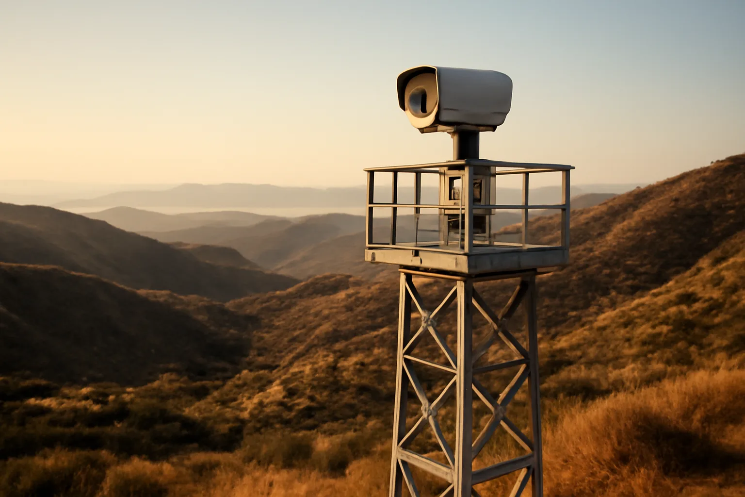
AI shows up in wildfire work in three real places today: detection, risk scoring, and modeling. It is not showing up as a device you buy for your house that stops a fire. Detection systems like ALERTCalifornia (a partnership between UC San Diego and CAL FIRE) run machine learning models over a network of over 1,100 mountaintop cameras to spot smoke plumes before 911 calls come in. CAL FIRE has said these AI-assisted camera detections have caught fires within minutes of ignition, sometimes before any human report. That's genuinely useful. It gets engines rolling faster, which matters more than almost anything else in the first hour of a fire. On the insurance side, companies use AI-driven aerial and satellite imagery (firms like Zesty.ai and Cape Analytics do this) to score individual properties for vegetation density, roof condition, and defensible space compliance from above, without a human ever knocking on your door. This is a big part of why homeowners are getting non-renewal letters based on an algorithm's read of a satellite photo, sometimes one that's a year or two old and doesn't reflect the clearing work you already did. Third, agencies use AI-assisted fire behavior modeling (building on tools like FARSITE and newer machine-learning layers) to predict spread direction and speed for evacuation planning. This helps first responders. It does very little for your specific parcel decisions today. None of this replaces the boring physical work: clearing brush, hardening vents, moving the woodpile. AI speeds up detection and scoring. It doesn't do the labor.
Can AI tell my insurance company my house is high risk, and is that fair
Yes, and it's already happening. Several major insurers and their reinsurance data partners use AI-scored aerial imagery to assess wildfire risk at the individual parcel level, and that score can factor into non-renewal or premium decisions. The fairness problem is real and well documented. Imagery can be outdated, misread a cleared lot as brush-covered, or miss recent hardening work like a new Class A roof or ember-resistant vents. California regulators have pushed back on this specific issue. The California Department of Insurance's Sustainable Insurance Strategy, finalized in 2024, requires insurers writing more business in wildfire distressed areas to give discounts for wildfire mitigation, and directs insurers to consider the CAL FIRE Fire Hazard Severity Zone maps alongside community and individual mitigation actions, not aerial imagery alone [1]. The practical response isn't to argue with an algorithm. It's to build your own paper trail that beats it: dated photos, receipts, a written scope of the defensible space zones you've cleared, and a copy of your local fire district's inspection checklist if one exists. If you got a non-renewal or inspection letter, that documentation is what you send back, not a dispute over whether the AI model is accurate. We don't file claims or negotiate with insurers on your behalf here; you prepare the documentation and send it yourself.
When does the California defensible space law take effect (the 5-foot ember zone)
California's expanded defensible space law, requiring an ember-resistant Zone 0 within 5 feet of structures, was enacted as part of SB 63 (2020) and amendments under AB 3074, but as of early 2026 CAL FIRE's Zone 0 regulations are still in the formal rulemaking process and have not taken final effect statewide [2]. CAL FIRE's Board of Forestry has been developing the specific Zone 0 regulation language for years, with draft regulations circulated for public comment. The statute (Public Resources Code Section 4291) sets the legal framework requiring 100 feet of defensible space in three zones, and the ember-resistant zone within 5 feet was added by AB 3074 in 2020, but the actual enforceable regulation defining what materials and setups qualify has been delayed multiple times. Check CAL FIRE's Board of Forestry and Fire Protection rulemaking page for the current status, since this date has moved before and will likely move again before final adoption [2]. This matters practically: don't wait for the regulation to be finalized before you act. Insurers are already asking about the 5-foot zone in inspection letters, and the smart move is to treat SB 63's intent, no combustible material within 5 feet of your foundation, as already in effect for your own planning. Gravel, pavers, or bare soil in that zone, no mulch, no wood fencing touching the house, no stored firewood against the wall. See our guide on fire safe landscaping next to your house for the zone-by-zone breakdown.
What fire-safe home requirements take effect in 2026
For California, the honest answer is: several requirements are in motion but final adoption dates keep sliding, so check your county building department and CAL FIRE's current rulemaking status directly rather than trusting any fixed date online, including this one. What's more settled: the Chapter 7A building code requirements (California Building Code, Title 24) already apply to new construction and major remodels in Wildland-Urban Interface Fire Areas, requiring ember- and flame-resistant materials for roofing, vents, siding, and decking [3]. If you're building new or doing a substantial remodel in a WUI zone, Chapter 7A applies now, not in 2026. Oregon took a different path. After years of controversy over its wildfire hazard map (the state pulled an earlier version in 2022 after public backlash), Oregon's Department of Forestry and Department of Consumer and Business Services re-released a revised statewide wildfire hazard map in 2025, and defensible space and building code standards tied to that map are being phased in for properties in the highest hazard designations [4]. Oregon homeowners should check their parcel status directly on ODF's wildfire hazard map tool, since designation drives which rules apply to that specific property. Colorado and Arizona don't have a single statewide defensible space mandate like California's; requirements come from county or fire district codes instead. That means your actual rule set depends entirely on which fire district you're in. [Guided fill-in: check your specific fire district's current defensible space and building code requirements, since they vary by jurisdiction even within the same state.]
Why won't people follow the defensible space law in California
The honest reasons are cost, labor, aesthetics, and enforcement gaps, roughly in that order based on what CAL FIRE and county reporting show. Clearing 100 feet of defensible space on a sloped, brush-covered lot isn't a weekend project for most homeowners. It commonly requires hiring a crew, and costs can run from a few hundred dollars for a small flat lot to several thousand for a large, steep, heavily vegetated parcel. For homeowners already stretched by rising insurance premiums or a non-renewal, that's a hard expense to justify, even though it may be the single thing that keeps their policy or gets a re-inspection to pass. Enforcement is also inconsistent. Public Resources Code Section 4291 gives CAL FIRE and local fire authorities the power to inspect and require compliance, with fines possible for failure to maintain defensible space, but actual inspection rates vary enormously by county and fire district, and many rural parcels haven't seen an inspector in years. When the perceived odds of getting caught are low, some homeowners deprioritize the work. There's also a real aesthetic and ecological tension. Some homeowners genuinely value mature trees and native landscaping close to the house, and don't want to remove decades-old growth for a 5-foot ember zone. Others simply don't believe defensible space work would make a difference in a fast-moving, wind-driven fire, a belief that isn't entirely wrong for the most extreme fire behavior but is wrong for the majority of home ignitions, which studies attribute mainly to embers landing on flammable material near the structure rather than direct flame contact from the main fire front [5].
How can homeowners help prevent wildfires from starting
Most wildfires near homes start from human causes, not lightning, so prevention is mostly about controlling ignition sources on your own property and nearby land. CAL FIRE and the National Interagency Fire Center both report that roughly 85-90% of wildfires nationally are human-caused, including unattended campfires, debris burning, equipment sparks, and downed power lines. For homeowners specifically: don't mow dry grass midday in high wind, keep chainsaws and mowers away from dry vegetation during red flag warnings, maintain a spark arrestor on any outdoor equipment, and never leave a campfire or debris burn unattended even for a few minutes. Beyond your own habits, the biggest lever most homeowners actually control is reducing fuel load around the structure itself: clearing dead vegetation, removing ladder fuels (shrubs and small trees that let fire climb into tree canopies), and keeping gutters free of dry leaves and pine needles. Ready.gov's wildfire preparedness guidance specifically recommends clearing leaves and debris from gutters, roof, and eaves, since ember ignition through debris-clogged gutters is one of the most common ways homes catch fire during a wildfire event, not direct flame contact. If you're near a fire district that does chipping programs or slash pickup days, use them. Piling cleared brush and never disposing of it just creates a new fuel source in your yard.
How should I prepare for a wildfire this season
Preparation has two tracks that both matter: hardening the property before fire season, and having an evacuation plan ready before you ever get a warning. For the property: work outward from the house. Zone 0 (0-5 feet) should have no combustible mulch, no wood fencing touching the structure, and gravel or hardscape instead. Zone 1 (5-30 feet) needs well-spaced, low, irrigated plants with dead material removed. Zone 2 (30-100 feet) needs reduced fuel continuity, meaning trees thinned and spaced so fire can't easily jump crown to crown. CAL FIRE's defensible space guidance breaks this down zone by zone [6]. See our full defensible space zones breakdown for specifics on each distance. For the house itself: Class A roofing, ember-resistant vents (1/8 inch mesh or listed WUI vents), and enclosed eaves matter more than almost any landscaping choice, because most home ignitions during wildfires happen from embers entering vents or landing on debris, not from direct flame contact with the main fire [5]. Our home hardening guide covers vent retrofits and roofing priorities in more detail. For the family: Ready.gov recommends having a go-bag prepared for every household member, a written evacuation plan with two routes out of the neighborhood, and a designated meeting point outside the immediate area, done well before any fire watch or warning is issued for your zone. Document everything as you go. Take dated photos of cleared brush, new vents, roof work, and receipts for any contractor work. This is exactly the kind of record insurers and fire district inspectors ask for, and it's also the foundation of what's in the $99 one-time Wildfire Insurance Survival Kit, which organizes this documentation into a format built for inspection letters and non-renewal responses. It doesn't file claims or talk to your insurer for you; you send it yourself.
How do I prevent forest fires and avoid contributing to one nearby
Preventing forest fires near your property comes down to the same fuel and ignition principles as home defense, just applied at a larger scale and often on land you don't fully control. If you own or manage acreage beyond your immediate home site, thinning overstocked stands, removing dead and downed wood, and creating fuel breaks along property lines all reduce the chance that a fire crossing your land turns into a crown fire. The U.S. Forest Service and state forestry agencies (like CAL FIRE's Vegetation Management Program) offer cost-share programs in many states to help offset the cost of this kind of larger-scale fuel reduction work . It's worth checking with your state forestry agency directly, since program funding and eligibility change year to year. On the ignition side: report unattended campfires or suspicious smoke immediately rather than assuming someone else will. Avoid parking vehicles with hot undercarriages on dry grass. If you live near forest service or BLM land, know the current fire restriction level for your area, since some years have full burn bans that carry real penalties for violation. If your property borders wildland, coordinating with neighbors on shared defensible space and fuel breaks matters more than most people realize. Fire doesn't respect property lines, and a neighbor's overgrown lot right next to your cleared one still puts your house at risk. See our piece on only you can prevent wildfires for more on the human-ignition side of this.
Is Santa Barbara safe from fire risk
No location in the wildland-urban interface of coastal or foothill California is meaningfully "safe" from fire risk, and Santa Barbara County has direct historical evidence of that: the 2017 Thomas Fire burned over 281,000 acres and was followed by the deadly Montecito debris flow in January 2018 that killed 23 people, a disaster directly tied to the burned, denuded slopes above town . CAL FIRE's Fire Hazard Severity Zone maps classify large portions of the Santa Barbara foothills and areas like Montecito, San Roque, and the Riviera as Moderate to Very High fire hazard severity zones, meaning defensible space and Chapter 7A building requirements apply directly to homes there . Downtown Santa Barbara and areas well removed from wildland vegetation carry lower direct wildfire risk, but the county as a whole sits squarely in one of the more fire-exposed regions of the state, with the Santa Ynez Mountains backdrop creating classic wind-driven fire conditions during Sundowner wind events specific to that area. If you own property anywhere in the Santa Barbara foothills, the Riviera, Montecito, or similar terrain, check your specific parcel's Fire Hazard Severity Zone designation on CAL FIRE's map tool rather than relying on general reputation about the area. "Is my neighborhood safe" is really a parcel-level question, not a city-level one.
What's the difference between AI-based fire detection and traditional detection
| 911 caller reports | Minutes to hours, highly variable | Wherever people are present | Blind in remote areas, at night, low visibility | |
|---|---|---|---|---|
| Staffed lookout towers | Minutes during staffed hours | Limited by tower placement and staffing budget | Not staffed 24/7 in most regions now | |
| AI camera network (ALERTCalifornia) | Often under 10-15 minutes | 1,100+ camera sites statewide | Can miss small fires under smoke/fog, needs power/connectivity | |
| Satellite thermal detection (NASA FIRMS, GOES) | Roughly 1-3 hours between passes for some satellites | Global | Lower resolution, delayed by orbit/pass timing | For homeowners, none of this changes what you should do at the property level. Faster detection means faster response, which can matter enormously in a fast-moving fire, but it doesn't substitute for defensible space or a hardened structure. A fire detected in 8 minutes instead of 40 still needs somewhere to slow down when it reaches your property line. |
Traditional wildfire detection relies mainly on 911 calls from people seeing smoke, plus staffed fire lookout towers, which have declined sharply in number over the past 50 years. AI-based detection adds a continuous, automated layer: computer vision models scanning live camera feeds around the clock, flagging smoke signatures before any human notices. The ALERTCalifornia network, run by UC San Diego in partnership with CAL FIRE, now covers over 1,100 camera locations across California and uses machine learning trained on smoke imagery to alert dispatch centers, sometimes catching ignitions within minutes. Compare that to a purely 911-based system, where detection time depends entirely on whether someone happens to be nearby, awake, and looking in the right direction. | Detection method | Typical speed | Coverage | Key limitation |
What are the real limits of AI in wildfire mitigation right now
AI is good at pattern recognition across huge amounts of imagery and sensor data. It is not good at judgment calls that need local knowledge, and it can't do physical labor. Detection models still generate false positives (dust clouds, fog, and even large trucks kicking up debris have triggered smoke alerts in some camera networks) and can miss small or slow-starting fires under certain lighting and weather conditions. Risk-scoring models used by insurers depend heavily on the recency and resolution of aerial imagery; a model working from an 18-month-old satellite pass will miss the vent retrofit or brush clearing you did last spring, which is exactly why paper documentation from the homeowner still matters so much. Modeling tools for fire spread prediction help agencies and firefighters allocate resources, but they're built on historical weather and fuel data, and every major fire season produces behavior that outpaces the models, especially under extreme wind events. Researchers openly acknowledge this; fire behavior modeling remains probabilistic guidance, not a guarantee, and agencies use it alongside, not instead of, on-the-ground fire behavior analysts. The bottom line: treat AI tools as things that happen to you (faster detection, algorithmic insurance scoring) rather than tools you personally operate to reduce your risk. The actual risk-reduction work, clearing brush, hardening vents, maintaining gutters, documenting compliance, is still manual, still yours, and still the thing that most reliably keeps your home standing and your policy in force.
Frequently asked questions
When does the California defensible space law go into effect?
The core defensible space law (Public Resources Code 4291, requiring 100 feet of clearance) has been in effect for years. The newer 5-foot ember-resistant Zone 0 requirement, added by AB 3074 in 2020, is still going through CAL FIRE Board of Forestry rulemaking as of early 2026 and hasn't been finalized statewide. Check CAL FIRE's current rulemaking page for the latest status before assuming a fixed date.
Why won't people follow the defensible space law in California?
Mainly cost and labor: clearing a large sloped lot can run from a few hundred to several thousand dollars. Enforcement is also inconsistent across counties, so many homeowners perceive low odds of being inspected. Some also value mature landscaping or doubt clearing helps against extreme wind-driven fires, though most home ignitions actually come from embers, not direct flame contact.
How can we prevent forest fires?
Most forest and wildfires are human-caused. Prevention means never leaving campfires or debris burns unattended, keeping equipment spark arrestors maintained, avoiding mowing dry grass in high wind, reporting unattended fires immediately, and thinning fuel loads on land you manage. Roughly 85-90% of U.S. wildfires start from human activity rather than lightning, per federal fire agency data.
How do I prepare for a wildfire?
Harden your home zone by zone: no combustibles within 5 feet, clear gutters and roof debris, install ember-resistant vents, and use Class A roofing. Separately, prepare a go-bag, a written evacuation plan with two exit routes, and a family meeting point, all before any warning is issued. Document your mitigation work with dated photos for insurance purposes.
What fire-safe home requirements take effect in 2026?
There's no single nationwide 2026 rule. California's Chapter 7A building code already applies to new construction and remodels in WUI zones. California's 5-foot Zone 0 regulation is still in rulemaking. Oregon phased in requirements tied to its revised 2025 wildfire hazard map. Check your specific state fire marshal and county building department for your parcel's actual requirements.
Is Santa Barbara safe from wildfire?
No area of Santa Barbara County's foothills is fire-safe in any absolute sense. The 2017 Thomas Fire burned over 281,000 acres there, and the Montecito debris flow that followed killed 23 people. CAL FIRE classifies much of the foothill area as Moderate to Very High fire hazard severity zone. Check your specific parcel on CAL FIRE's hazard map rather than trusting general reputation.
Can AI actually predict where a wildfire will spread?
AI-assisted fire behavior models improve on older tools by incorporating more real-time weather and fuel data, and agencies use them for evacuation and resource planning. But they remain probabilistic, not guarantees, and every major fire season sees behavior, especially under extreme wind, that outpaces model predictions. Treat model output as one input alongside official evacuation orders, never a substitute for them.
Does AI-scored aerial imagery affect my homeowners insurance?
Yes. Insurers increasingly use AI-analyzed satellite and aerial imagery to score individual parcels for vegetation density and roof condition, and that score can influence non-renewal decisions. California's 2024 Sustainable Insurance Strategy requires insurers to also factor in mitigation actions and CAL FIRE hazard zone data, not imagery alone, when writing more business in distressed wildfire areas.
How fast can AI wildfire detection systems spot a new fire?
CAL FIRE and UC San Diego's ALERTCalifornia network, using AI-assisted analysis across more than 1,100 mountain cameras, has flagged some fires within roughly 10-15 minutes of ignition, sometimes before any 911 call comes in. Detection speed still varies with visibility, smoke behavior, and camera placement, and small or slow-starting fires can be missed.
What's the single most effective thing a homeowner can do to prevent home ignition during a wildfire?
Clear the 5-foot zone around your foundation of anything combustible and install ember-resistant vents. Research on home losses in wildfires consistently points to embers entering vents or igniting debris near the structure, not direct flame contact from the main fire, as the dominant cause of home ignition during wildfire events.
Do I need a permit to clear defensible space around my house?
Generally no for routine brush clearing and vegetation thinning on your own property, but rules vary by county and some jurisdictions require permits for removing certain protected trees or for larger-scale mechanical clearing. Check with your local fire district or county planning department, since defensible space rules and permit requirements differ by jurisdiction.
Will clearing defensible space actually lower my insurance premium?
It can help you keep coverage or pass a re-inspection, though it doesn't guarantee a lower premium in every case. California's Sustainable Insurance Strategy requires participating insurers to offer discounts for documented wildfire mitigation actions. Documenting your work with dated photos and receipts is what supports any request for reconsideration; you send this yourself, since we don't negotiate with insurers directly.
Sources
- California Department of Insurance, Sustainable Insurance Strategy: 2024 regulatory strategy requiring insurers to factor in wildfire mitigation actions and hazard zone data for wildfire distressed areas
- California Board of Forestry and Fire Protection, Zone 0 rulemaking: Status of California's ember-resistant Zone 0 defensible space regulation rulemaking under SB 63 / AB 3074
- California Building Code Chapter 7A, Office of the State Fire Marshal: Chapter 7A building material requirements for new construction and remodels in Wildland-Urban Interface Fire Areas
- USDA Forest Service, Firewise home ignition zone research (Cohen): Most home ignitions during wildfires result from ember contact with combustible material near the structure rather than direct flame contact from the fire front
- National Interagency Fire Center, wildfire statistics: Majority of U.S. wildfires are human-caused rather than started by lightning
- CAL FIRE, Vegetation Management Program: State-supported fuel reduction and vegetation management cost-share programs for larger landholdings