Last updated 2026-07-25
TL;DR
Defensible space means removing flammable material in three zones around your home: 0-5 feet (noncombustible), 5-30 feet (lean, clean, low fuel), and 30-100 feet (reduced density, spaced trees). California's ember-resistant Zone 0 regulation, originally set for 2023, still has no enforcement date; the state fire marshal has not finalized the rule as of mid-2025.
What does defensible space actually look like around a house?
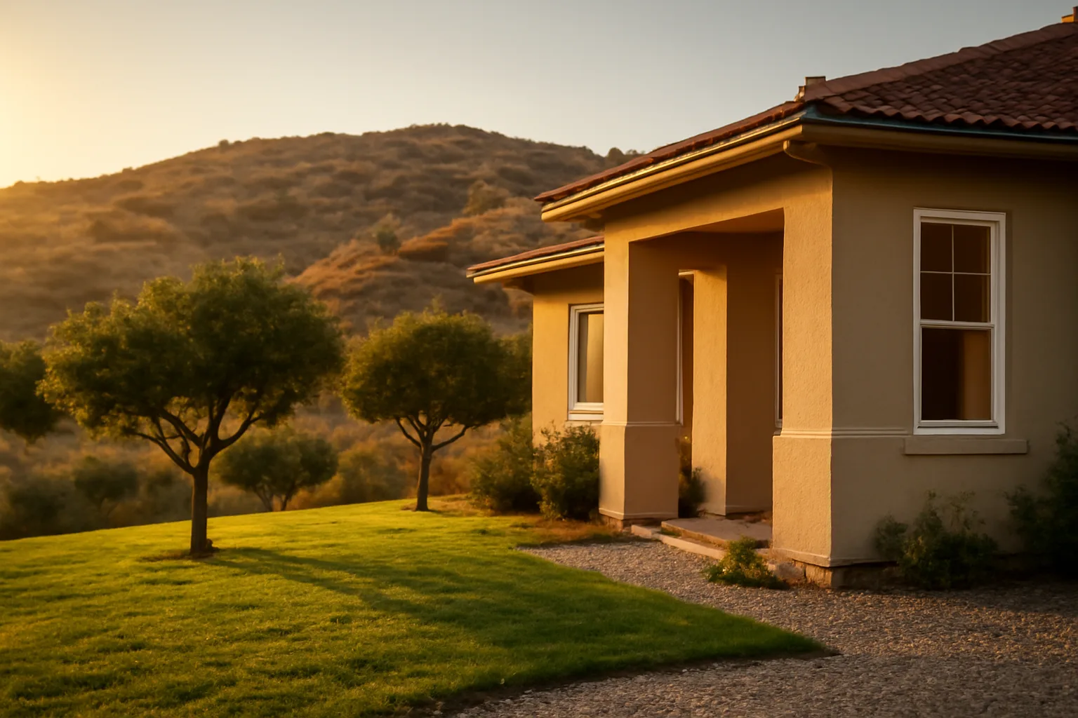
Picture the same lot from the air, split into three rings. Right against the foundation, there's bare gravel, concrete, or pavers, no mulch, no shrubs touching siding, nothing that can catch an ember and walk it into the house. A few feet out, the planting beds thin out: single trees with grass or hardscape between them, no continuous line of bushes running under windows. Past 30 feet, it looks like a normal yard again, but trees are spaced and limbed up, and dead branches and needle litter don't pile against fences or sheds. CAL FIRE's official framework calls these Zone 0 (0-5 feet), Zone 1 (5-30 feet), and Zone 2 (30-100 feet), and the agency is explicit that "defensible space is the buffer you create by removing dead plants, grass and weeds" and keeping remaining vegetation "well maintained and less flammable". That's not landscaping advice in the abstract. It's the difference between a house that survives an ember storm and one that doesn't, because most homes in wildfires ignite from embers landing on or near the structure, not from a wall of flame arriving at the property line. A good example beats a rulebook every time, so this piece walks through what each zone looks like in practice, what a real inspection letter is asking for, and where people get stuck. For the fuel-break specifics by zone, see defensible and fire safe landscaping california next to house.
What does Zone 0 (the ember-resistant zone) look like in practice?
Zone 0 runs from the foundation out to 5 feet, and it's the zone CAL FIRE and most fire behavior researchers treat as the highest-leverage 5 feet on the property. A compliant Zone 0 has no combustible mulch, no wood chips, no stacked firewood, no dry leaf litter, and no shrubs or vines touching the siding. Instead you see decomposed granite, pavers, concrete, or well-irrigated, isolated low groundcover kept short and green. Real examples: a single potted succulent on a stone patio slab, fine. A row of juniper hedges hugging the foundation under a wood-frame window, that's a textbook example of what not to do, since juniper is notoriously resinous and ignites easily. A wooden fence that attaches directly to the house wall, also a problem, because fences function as a wick that carries flame from the yard to the structure; CAL FIRE guidance specifically calls out attached fencing and gates as an ignition path into Zone 0. Here's the twist: California passed a law in 2020 (AB 3074) directing the Board of Forestry and the State Fire Marshal to write ember-resistant Zone 0 building code standards, and set a target implementation date, but as of mid-2025 that regulation still has not been finalized or given an enforcement date [1] [2]. So if you're asking when the California defensible space law goes into effect for Zone 0, specifically, the honest answer is: not yet, and the timeline has already slipped past its original target. Existing defensible space law (Public Resources Code 4291), which covers the 100-foot clearance, has been in effect for years and is enforced today [3].
What does Zone 1 (5-30 feet) look like when it's done right?
Zone 1 is the "lean, clean, and green" zone. In practice that means grass mowed to under 4 inches, trees pruned so the lowest branches sit at least 6 feet off the ground (or a third of the tree's height, whichever is less), and at least 10 feet of horizontal space between tree canopies unless they're isolated specimen trees. A good real-world example: a backyard with three oak trees spaced 15 feet apart, each limbed up to eye level, with mowed grass and a gravel path underneath instead of continuous shrub cover. A bad example, and a common one in wildland-urban interface neighborhoods: a row of arborvitae or leyland cypress planted as a privacy screen along a fence line, canopy touching canopy, branches sweeping the ground. That configuration is sometimes called a "fuel ladder," because low branches let a ground fire climb into the crown, and a continuous line of touching canopies then carries fire structure to structure. Firewood stacks are a classic Zone 1 failure. A cord of firewood stacked against a garage wall inside the 30-foot zone is one of the most common items flagged on defensible space inspections; CAL FIRE guidance recommends firewood be stored outside of Zone 1 entirely, or at minimum well clear of structures. Propane tanks need 10 feet of clearance to bare mineral soil in all directions, per CAL FIRE's defensible space checklist.
What does Zone 2 (30-100 feet) look like?
Zone 2 extends from 30 feet out to 100 feet from the structure (or to the property line, whichever comes first), and the standard here is reduced fuel volume rather than bare ground. Grass should be cut to 4 inches or less, dead vegetation and fallen leaves removed, and trees thinned so there's at least 10 feet between canopies (more on steeper slopes, since fire moves faster uphill). An example of a well-managed Zone 2: a wooded lot where the understory brush has been cleared out, dead and downed wood removed, and remaining trees pruned up 6 feet, so if a fire does move through, it stays low and doesn't have a ladder into the canopy. An example of a Zone 2 problem: a hillside covered in dry, unmanaged chaparral or dense manzanita right up to the 100-foot line, with a steep slope facing the prevailing wind, since slope and fuel continuity both increase fire spread rate. On slopes over 20%, CAL FIRE recommends fuel treatments extend beyond the standard 100 feet because fire preheats fuel more efficiently moving uphill. Homes in wildland-urban interface counties are legally required to maintain 100 feet of defensible space (or to the property line) under Public Resources Code 4291, and insurers increasingly ask for photo documentation of all three zones, more than Zone 1 [3].
When does the California defensible space law go into effect?
The core 100-foot defensible space requirement (PRC 4291) is not new; it's been law for years and applies now to homes in State Responsibility Areas and designated wildland-urban interface zones. What's still pending is the newer, stricter Zone 0 ember-resistant standard. AB 3074 (2020) directed the Board of Forestry and Fire Protection, in coordination with the Office of the State Fire Marshal, to develop regulations for a 0-to-5-foot ember-resistant zone and set an original target of January 1, 2023 for the requirement to apply to existing structures in high fire hazard severity zones [1]. That date came and went without a finalized regulation. As of the most recent public updates from CAL FIRE and the Board of Forestry, the Zone 0 regulation is still in the rulemaking process, with no confirmed enforcement start date [2]. So when people search "what fire safe [requirements] for homes take effect in 2026," there's no single confirmed 2026 statewide Zone 0 enforcement date on the books as of this writing. Homeowners in high or very high fire hazard severity zones should treat Zone 0 compliance as something to get ahead of now, both because insurers are already asking for it informally and because the rule could finalize with a short compliance window once it does. Check your local fire district and county building department for any interim local ember-resistant zone ordinances, since some jurisdictions have moved ahead of the state.
Why won't people follow the defensible space law in California?
Nobody has a single clean study measuring statewide noncompliance rates, but CAL FIRE inspection data and academic surveys point to a consistent set of reasons, and cost is the biggest one. Removing mature trees, regrading slopes, or replacing wood mulch with gravel across a full quarter-acre lot can run into the thousands of dollars, and low and moderate-income homeowners, especially those on fixed incomes in older rural developments, often can't absorb that cost in one season [4]. A second reason is simple confusion about scope. People understand "clear brush" but don't realize a fuel-thinning code covers pruning height, canopy spacing, and species choice, more than cutting weeds. A third is competing priorities: a household juggling insurance non-renewal, a hostile housing market, and a full-time job often triages defensible space behind more immediate financial pressure, even when they know the risk. There's also a documented behavioral gap between belief and action. Research on wildfire risk perception (published through university extension programs and USDA Forest Service-funded studies) has repeatedly found that homeowners who believe their property is at risk still frequently delay mitigation work, citing cost, time, aesthetic preferences for lush landscaping, and uncertainty about whether the work will actually change their insurance outcome [5]. Enforcement is also uneven; many fire districts rely on self-certification or complaint-driven inspection rather than routine sweeps, which reduces the practical pressure to comply even where the law is clear.
How to prevent wildfires around your own home
You can't prevent wildfires in the wildland sense. That's a landscape-scale problem involving fuel loads, drought, and ignition sources CAL FIRE and the Forest Service manage at scale. But at the parcel level, "preventing" a wildfire loss really means removing the things that let embers become house fires. The highest-leverage, lowest-cost moves: clear gutters and roof valleys of leaf litter and pine needles (a classic ember catch point), screen attic and foundation vents with 1/8-inch metal mesh to block ember entry, and move anything combustible off the Zone 0 zone against the house, including welcome mats, wood fences that touch the structure, and firewood piles. CAL FIRE's home hardening guidance treats vents and roofs as the two most common ignition points in home losses during wildfires. Beyond your own lot, human-caused ignitions (campfires, equipment sparks, downed power lines, fireworks) account for the large majority of wildfire starts nationally, so basic outdoor fire discipline (fully extinguishing campfires, avoiding mowing dry grass midday, keeping vehicles off dry vegetation) matters at a community level even though it doesn't change your own defensible space compliance [6].
How to prepare for a wildfire (a real evacuation-ready checklist)
Preparing for a wildfire means building three things ahead of time: a go-bag, a documented home inventory, and a fire-adapted property. Ready.gov recommends assembling an emergency supply kit with water (one gallon per person per day for several days), a battery or hand-crank radio, medications, and copies of important documents, and creating a family communication plan before a fire threat is imminent. On the documentation side, insurers frequently deny or slow-walk claims when a homeowner can't prove pre-loss condition or value of belongings. A simple video walkthrough of every room, plus photos of major systems (roof, water heater, electrical panel) and receipts for major purchases, takes under an hour and is worth doing before any red flag arrives, not after. This is the kind of prep the $99 Wildfire Insurance Survival Kit builder is built around: pre-formatted documentation templates so you're not improvising this from scratch during an evacuation warning. To be clear, that kit helps you organize and send your own records; it does not file claims on your behalf, and it's not a substitute for talking to your own insurance agent or a licensed public adjuster about your policy. On the property side, know your evacuation routes in two directions, keep your car's gas tank at least half full during fire season, and have a plan for pets and livestock. Sign up for your county's emergency alert system; many California counties use Genasys or Everbridge-based reverse-911 systems that are opt-in, not automatic.
How to prevent forest fires and how to avoid forest fires
These two phrasings usually mean the same thing to most searchers: how do individuals reduce the odds of igniting or worsening a wildland fire while they're outdoors. Since the overwhelming majority of wildfires nationally are human-caused, not lightning-caused, the actions that matter most are small and behavioral [6]. Don't burn debris on windy or red-flag days; check your county's burn permit status before any outdoor burning, since permits are commonly suspended during dry, windy periods. Fully drown and stir campfires until they're cold to the touch, more than smoking-free; a campfire that looks out can still smolder and reignite hours later. Don't park or drive vehicles on dry grass, since catalytic converters can exceed 1,000°F and ignite vegetation on contact. Keep chainsaws, mowers, and grinders away from dry brush during peak fire season, and mow before 10am rather than in afternoon heat and wind. Report any unattended fire or smoke immediately rather than assuming someone else has already called it in.
How to prepare for forest fires as a homeowner or resident
For homeowners near forested land, preparation blends the personal evacuation planning above with property-level fuel management specific to forest fire behavior, which moves differently than grass or brush fire. Forest fires can generate long-range ember spotting, sometimes over a mile ahead of the main fire front under extreme wind conditions, so defensible space alone doesn't guarantee safety if embers ignite a roof or vent far from the fire line. Practical steps: maintain the full 100-foot defensible space where your lot allows it, coordinate with neighbors on shared fuel breaks since a single unmitigated adjacent lot can undercut your own work, and know your community's specific evacuation zone designation and trigger points (many California counties use tiered warning-to-order systems). Keep an N95 or P100 mask and eye protection accessible for smoke exposure during slow evacuations, and consider an air purifier with a HEPA filter for extended smoke seasons even in years without a direct fire threat nearby.
Is Santa Barbara safe from fire?
No California coastal or foothill community, including Santa Barbara, is meaningfully "safe" from wildfire risk, and Santa Barbara County has direct, repeated history proving it. The Thomas Fire (December 2017) burned over 281,000 acres across Ventura and Santa Barbara counties and was, at the time, the largest wildfire in modern California history by acreage [7]. It was followed almost immediately by the January 2018 Montecito debris flow, a rain-on-burn-scar disaster that killed 23 people, a direct consequence of the fire having stripped hillside vegetation weeks earlier [7]. Much of Santa Barbara's urban core sits adjacent to steep, chaparral-covered foothills, which CAL FIRE's Fire Hazard Severity Zone maps classify as high or very high severity zone in the wildland-urban interface areas ringing the city [8]. If you own property in or near Santa Barbara, Montecito, Goleta, or similar foothill communities, check your specific parcel against the CAL FIRE Fire Hazard Severity Zone viewer rather than relying on the city's general reputation; hazard zoning varies block by block, more than by town [8].
How can we prevent forest fires at a community level?
Individual defensible space work matters, but fire behavior researchers are clear that community-scale coordination changes outcomes more than any single yard. A single home with excellent Zone 0-2 compliance can still ignite from a neighboring, unmitigated property if fire crosses lot lines fast enough, which is part of why some fire departments and insurers are moving toward block-level or neighborhood-level defensible space assessment rather than parcel-by-parcel review alone. Practical community actions: organize a neighborhood chipper day or shared debris removal program (many California fire safe councils subsidize these), push for local ordinances requiring ember-resistant vents on new construction ahead of the state's stalled Zone 0 timeline, and support prescribed burn and fuel-reduction programs on adjacent public land, since federal and state agencies increasingly rely on prescribed fire to reduce the fuel loads that make catastrophic fires possible. Reporting downed power lines and unattended fires immediately remains one of the single highest-value individual actions, since a large share of the largest, most destructive California fires in the last decade have had utility infrastructure identified as a contributing ignition source in post-fire investigations.
What are common defensible space mistakes homeowners make?
The same handful of mistakes show up again and again on inspection reports and in post-fire loss investigations, and most are cheap to fix once you know to look for them. Mistake one: mulch or bark against the foundation in Zone 0. It looks tidy and holds moisture for plants, but it's exactly the kind of fine fuel that catches embers and smolders against siding. Mistake two: a wood fence or gate physically attached to the house, creating a direct flame path. Mistake three: firewood stacked against the garage or under a deck. Mistake four: gutters full of dry leaves and pine needles, an ember catch point most homeowners simply forget exists. Mistake five: shrubs planted directly under windows, which lets a small ground fire reach glass and vents quickly. Mistake six: dense, touching tree canopies along a fence line that create a continuous fuel ladder from ground to crown. Every one of these is inexpensive to correct compared to the cost of losing the house, and most take a single weekend to address for an average-sized lot. For rules specific to homes bordering forest service or state trust land, contractors who do commercial-scale clearing under public programs are worth comparing; see wildfire defensible space clearing contracts washington state dnr for how that model works in one state, and fire at a house for what happens when these gaps go unaddressed.
How do you document defensible space for an insurer or non-renewal appeal?
If you've received a non-renewal or inspection letter, the fastest, most credible response is dated photo and video documentation of all three zones, organized so an underwriter can review it in minutes, not an hour. Photograph Zone 0 from at least two angles per side of the house, showing bare ground or noncombustible material against the foundation. Photograph Zone 1 showing mowed grass, pruned tree bases, and cleared firewood. Photograph Zone 2 showing canopy spacing and cleared understory, with a wide shot showing the full 100-foot depth where your lot allows it. Date-stamp everything, keep a written log of contractor work (invoices, before/after photos, chipping or hauling receipts), and note any local fire district clearance letter or defensible space inspection certificate if your area issues one; check your specific fire district for whether they provide this, since practices vary widely by county and even by individual fire protection district within a county. This is where organized documentation genuinely helps: insurers respond better to a clean, dated packet than a pile of loose photos on a phone. That's the specific gap the Wildfire Insurance Survival Kit is built to close, a one-time $99 template system for organizing this material yourself. It does not file claims or promise reinstatement, and it's not legal or insurance advice; you're still the one sending the documentation and making your own case with your carrier.
Frequently asked questions
When does the California defensible space law go into effect?
The 100-foot defensible space requirement under Public Resources Code 4291 is already in effect and has been for years. The newer, stricter Zone 0 ember-resistant standard from AB 3074 (2020) missed its original January 2023 target and, as of mid-2025, still has no finalized enforcement date from the Board of Forestry or State Fire Marshal.
What fire safe requirements for homes take effect in 2026?
No confirmed statewide 2026 enforcement date for California's Zone 0 ember-resistant zone rule exists as of this writing; the regulation authorized by AB 3074 remains in the rulemaking process. Some counties and fire districts have adopted their own interim ember-resistant zone or vent requirements ahead of the state, so check local ordinances directly.
Why won't people follow the defensible space law in California?
Cost is the biggest reason; full-lot compliance can run thousands of dollars for tree removal, regrading, or mulch replacement. Other factors include confusion about what the law actually requires beyond weed clearing, competing financial priorities, and uneven enforcement, since many fire districts rely on self-certification rather than routine inspection.
How do you prevent wildfires from destroying your specific home?
Focus on ember entry points: screen vents with 1/8-inch metal mesh, clear gutters and roof valleys of debris, remove mulch and firewood from within 5 feet of the structure, and prune trees so branches don't touch the roof or walls. Most home losses in wildfires start from ember ignition near the structure, not direct flame contact.
How do you prepare for a wildfire if you get an evacuation warning?
Have a go-bag with water, medications, and documents ready year-round, keep your gas tank above half during fire season, and know two evacuation routes. Ready.gov recommends one gallon of water per person per day for several days and a family communication plan established before any fire threat becomes imminent.
What's the difference between Zone 0, Zone 1, and Zone 2?
Zone 0 (0-5 feet from the structure) requires noncombustible material like gravel or pavers with no mulch or attached wood fencing. Zone 1 (5-30 feet) requires lean, low, well-spaced vegetation with grass under 4 inches. Zone 2 (30-100 feet) requires reduced fuel density and 10 feet of canopy spacing between trees.
Is Santa Barbara safe from fire?
No. Santa Barbara County has direct wildfire history, including the 2017 Thomas Fire (over 281,000 acres) followed by the deadly 2018 Montecito debris flow. Much of the area bordering the foothills is mapped by CAL FIRE as high or very high Fire Hazard Severity Zone, so risk varies significantly by specific parcel, not by city reputation.
How can individuals help prevent forest fires?
Since most wildfires are human-caused, avoid burning debris on windy or red-flag days, fully drown campfires until cold, don't drive or park on dry grass, and report unattended fires or smoke immediately. At a community level, coordinated neighborhood fuel reduction and supporting prescribed burn programs matter more than any single yard's compliance.
What are the most common defensible space mistakes?
Mulch against the foundation, wood fences attached directly to the house, firewood stacked against structures, leaf-clogged gutters, shrubs planted under windows, and dense touching tree canopies along fence lines. All six are inexpensive to fix and show up repeatedly on inspection reports and post-fire loss investigations.
Do I need a professional inspection to prove defensible space compliance?
Not always; requirements vary by fire district, so check with your local fire department or county. Some districts issue defensible space compliance certificates after a field inspection; others rely on self-certification. Either way, your own dated photos and contractor invoices are useful backup documentation regardless of whether a formal inspection occurred.
How much does it cost to create defensible space around a house?
Costs vary enormously by lot size, slope, and existing vegetation, ranging from a few hundred dollars for a small, already-manageable yard to several thousand for larger lots needing tree removal, regrading, or professional clearing crews. There's no single reliable national average; get local quotes rather than relying on a national figure.
Does defensible space guarantee my house won't burn or my insurance won't be cancelled?
No. Defensible space significantly improves survival odds by reducing ember ignition points, but it doesn't guarantee outcomes against extreme fire behavior, and it doesn't guarantee an insurer will renew or reinstate a policy. Insurers weigh many other factors, including regional risk models and prior claims history.
Sources
- California Legislative Information, AB 3074 (2020): AB 3074 directed development of ember-resistant Zone 0 regulations with an original 2023 target date
- California Board of Forestry and Fire Protection, Zone 0 rulemaking status: Zone 0 ember-resistant zone regulation remains in the rulemaking process without a finalized enforcement date
- California Public Resources Code Section 4291: Legal requirement for 100 feet of defensible space around structures in State Responsibility Areas
- USDA Forest Service, Wildfire Risk Reduction and Homeowner Behavior research: Cost is a primary barrier to homeowner defensible space compliance
- University Extension wildfire risk perception research (e.g., Oregon State University Extension): Gap between homeowner risk perception and actual mitigation behavior due to cost, time, and aesthetic preference
- National Interagency Fire Center, wildfire statistics: The large majority of U.S. wildfires are human-caused rather than naturally ignited
- CAL FIRE, Thomas Fire incident archive: Thomas Fire burned over 281,000 acres in December 2017 across Ventura and Santa Barbara counties
- CAL FIRE, Fire Hazard Severity Zone Viewer: Santa Barbara area foothill and wildland-urban interface zones are mapped as high or very high Fire Hazard Severity Zone